You are here: Home > Network List > TA - USArray Transportable Network (new EarthScope stations) Stations List
> Station N32A Stulken Farm, Doniphan, NE, USA > Earthquake Result Viewer
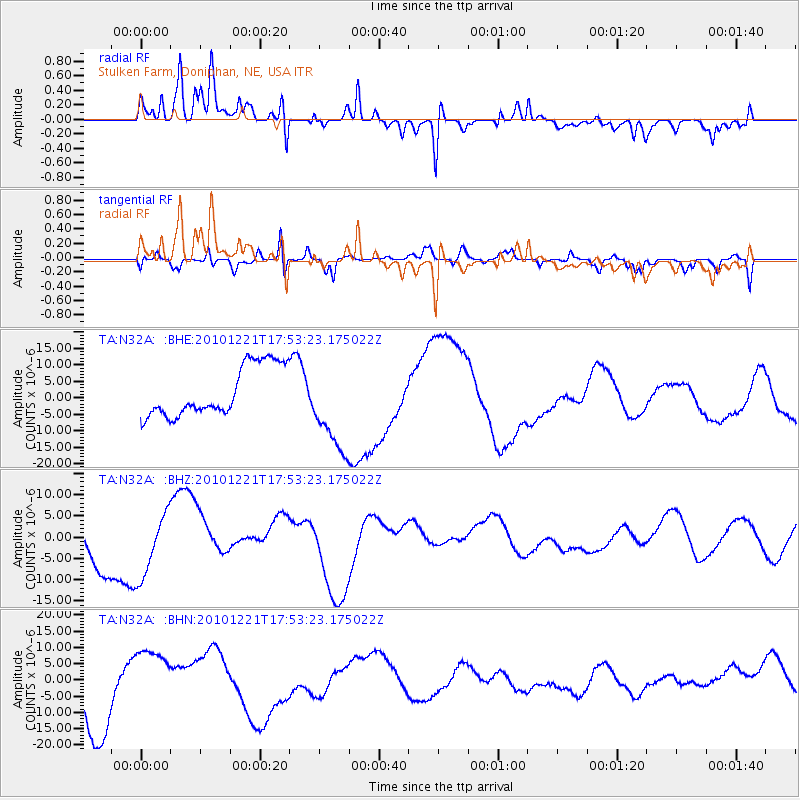
N32A Stulken Farm, Doniphan, NE, USA - Earthquake Result Viewer
*The percent match for this event was below the threshold and hence no stack was calculated.
| Earthquake location: |
Bonin Islands, Japan Region |
| Earthquake latitude/longitude: |
27.1/143.2 |
| Earthquake time(UTC): |
2010/12/21 (355) 17:40:47 GMT |
| Earthquake Depth: |
10 km |
| Earthquake Magnitude: |
5.5 MB |
| Earthquake Catalog/Contributor: |
WHDF/NEIC |
|
| Network: |
TA USArray Transportable Network (new EarthScope stations) |
| Station: |
N32A Stulken Farm, Doniphan, NE, USA |
| Lat/Lon: |
40.76 N/98.30 W |
| Elevation: |
587 m |
|
| Distance: |
91.6 deg |
| Az: |
41.902 deg |
| Baz: |
308.376 deg |
| Ray Param: |
$rayparam |
*The percent match for this event was below the threshold and hence was not used in the summary stack. |
|
| Radial Match: |
84.59567 % |
| Radial Bump: |
400 |
| Transverse Match: |
64.20342 % |
| Transverse Bump: |
400 |
| SOD ConfigId: |
343951 |
| Insert Time: |
2011-05-24 17:38:33.778 +0000 |
| GWidth: |
2.5 |
| Max Bumps: |
400 |
| Tol: |
0.001 |
|
Signal To Noise
| Channel | StoN | STA | LTA |
| TA:N32A: :BHZ:20101221T17:53:23.175022Z | 1.2566162 | 7.723281E-6 | 6.1460937E-6 |
| TA:N32A: :BHN:20101221T17:53:23.175022Z | 1.3558046 | 1.03147095E-5 | 7.607814E-6 |
| TA:N32A: :BHE:20101221T17:53:23.175022Z | 1.8152359 | 1.3828168E-5 | 7.6178353E-6 |
| Arrivals |
| Ps | |
| PpPs | |
| PsPs/PpSs | |


