You are here: Home > Network List > TA - USArray Transportable Network (new EarthScope stations) Stations List
> Station O34A Beatrice, NE, USA > Earthquake Result Viewer
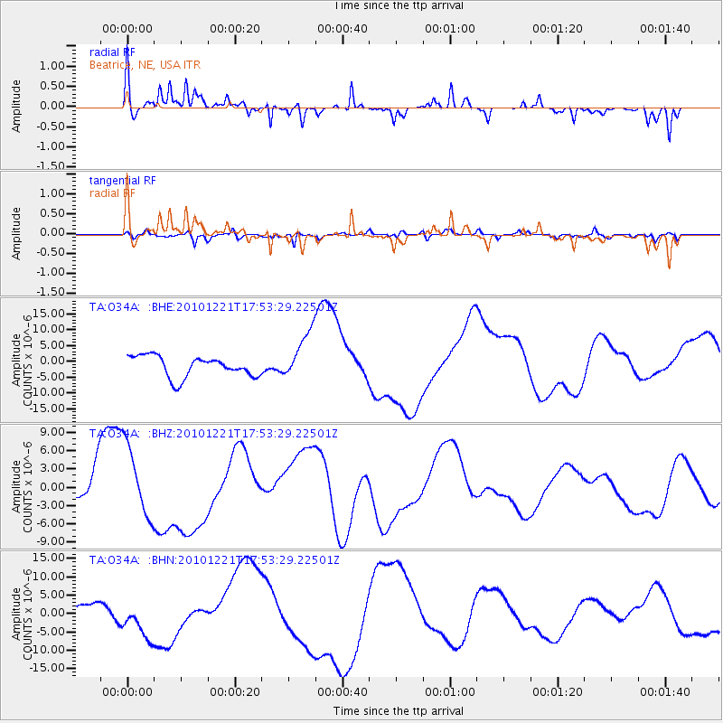
O34A Beatrice, NE, USA - Earthquake Result Viewer
*The percent match for this event was below the threshold and hence no stack was calculated.
| Earthquake location: |
Bonin Islands, Japan Region |
| Earthquake latitude/longitude: |
27.1/143.2 |
| Earthquake time(UTC): |
2010/12/21 (355) 17:40:47 GMT |
| Earthquake Depth: |
10 km |
| Earthquake Magnitude: |
5.5 MB |
| Earthquake Catalog/Contributor: |
WHDF/NEIC |
|
| Network: |
TA USArray Transportable Network (new EarthScope stations) |
| Station: |
O34A Beatrice, NE, USA |
| Lat/Lon: |
40.18 N/96.69 W |
| Elevation: |
409 m |
|
| Distance: |
92.9 deg |
| Az: |
41.586 deg |
| Baz: |
309.424 deg |
| Ray Param: |
$rayparam |
*The percent match for this event was below the threshold and hence was not used in the summary stack. |
|
| Radial Match: |
72.70579 % |
| Radial Bump: |
301 |
| Transverse Match: |
54.288647 % |
| Transverse Bump: |
400 |
| SOD ConfigId: |
346175 |
| Insert Time: |
2011-05-24 21:09:01.787 +0000 |
| GWidth: |
2.5 |
| Max Bumps: |
400 |
| Tol: |
0.001 |
|
Signal To Noise
| Channel | StoN | STA | LTA |
| TA:O34A: :BHZ:20101221T17:53:29.22501Z | 2.2712364 | 5.88864E-6 | 2.5927022E-6 |
| TA:O34A: :BHN:20101221T17:53:29.22501Z | 1.5225945 | 5.3826357E-6 | 3.5351734E-6 |
| TA:O34A: :BHE:20101221T17:53:29.22501Z | 2.3958673 | 7.8580115E-6 | 3.279819E-6 |
| Arrivals |
| Ps | |
| PpPs | |
| PsPs/PpSs | |


