You are here: Home > Network List > TA - USArray Transportable Network (new EarthScope stations) Stations List
> Station M35A Neola, IA, USA > Earthquake Result Viewer
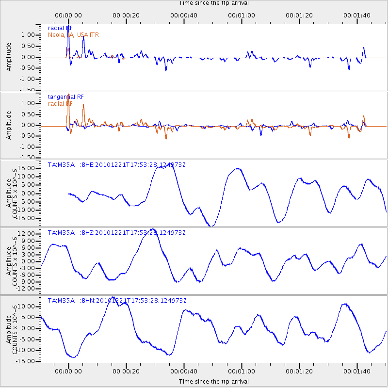
M35A Neola, IA, USA - Earthquake Result Viewer
*The percent match for this event was below the threshold and hence no stack was calculated.
| Earthquake location: |
Bonin Islands, Japan Region |
| Earthquake latitude/longitude: |
27.1/143.2 |
| Earthquake time(UTC): |
2010/12/21 (355) 17:40:47 GMT |
| Earthquake Depth: |
10 km |
| Earthquake Magnitude: |
5.5 MB |
| Earthquake Catalog/Contributor: |
WHDF/NEIC |
|
| Network: |
TA USArray Transportable Network (new EarthScope stations) |
| Station: |
M35A Neola, IA, USA |
| Lat/Lon: |
41.47 N/95.69 W |
| Elevation: |
363 m |
|
| Distance: |
92.7 deg |
| Az: |
40.114 deg |
| Baz: |
310.148 deg |
| Ray Param: |
$rayparam |
*The percent match for this event was below the threshold and hence was not used in the summary stack. |
|
| Radial Match: |
55.38214 % |
| Radial Bump: |
392 |
| Transverse Match: |
40.862537 % |
| Transverse Bump: |
274 |
| SOD ConfigId: |
346175 |
| Insert Time: |
2011-05-24 21:09:36.289 +0000 |
| GWidth: |
2.5 |
| Max Bumps: |
400 |
| Tol: |
0.001 |
|
Signal To Noise
| Channel | StoN | STA | LTA |
| TA:M35A: :BHZ:20101221T17:53:28.124973Z | 1.3289405 | 4.3804775E-6 | 3.296218E-6 |
| TA:M35A: :BHN:20101221T17:53:28.124973Z | 2.5201952 | 1.2756973E-5 | 5.0618987E-6 |
| TA:M35A: :BHE:20101221T17:53:28.124973Z | 6.908228 | 1.7625722E-5 | 2.55141E-6 |
| Arrivals |
| Ps | |
| PpPs | |
| PsPs/PpSs | |


