You are here: Home > Network List > TA - USArray Transportable Network (new EarthScope stations) Stations List
> Station J32A Parkston, SD, USA > Earthquake Result Viewer
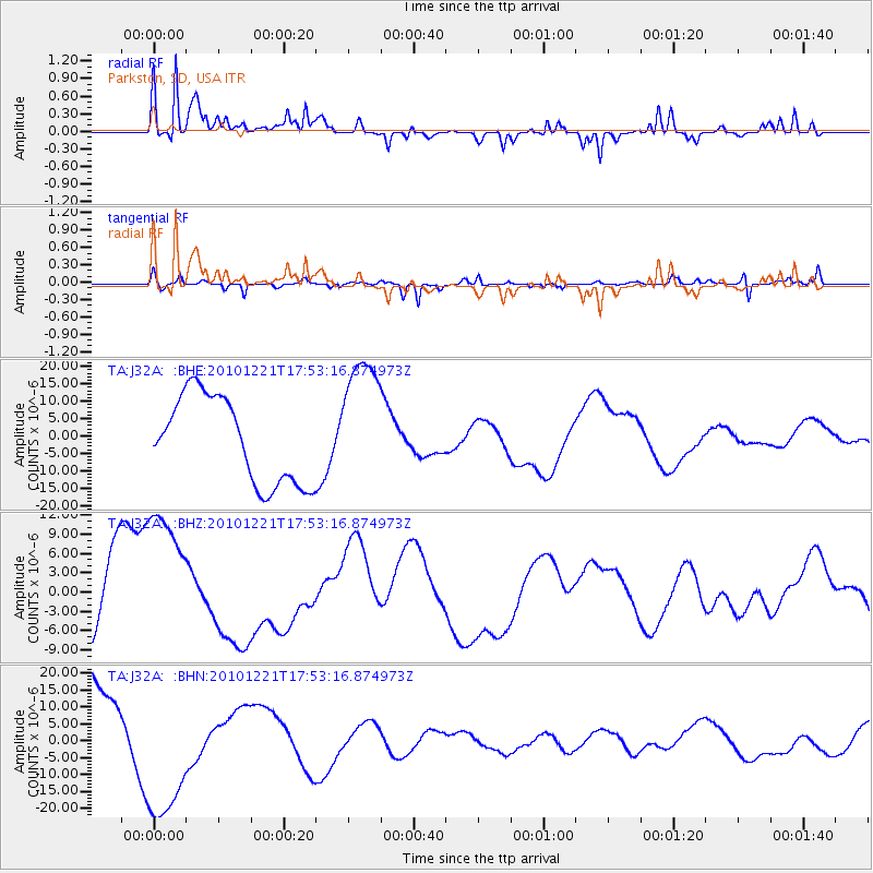
J32A Parkston, SD, USA - Earthquake Result Viewer
*The percent match for this event was below the threshold and hence no stack was calculated.
| Earthquake location: |
Bonin Islands, Japan Region |
| Earthquake latitude/longitude: |
27.1/143.2 |
| Earthquake time(UTC): |
2010/12/21 (355) 17:40:47 GMT |
| Earthquake Depth: |
10 km |
| Earthquake Magnitude: |
5.5 MB |
| Earthquake Catalog/Contributor: |
WHDF/NEIC |
|
| Network: |
TA USArray Transportable Network (new EarthScope stations) |
| Station: |
J32A Parkston, SD, USA |
| Lat/Lon: |
43.37 N/97.85 W |
| Elevation: |
399 m |
|
| Distance: |
90.3 deg |
| Az: |
39.656 deg |
| Baz: |
308.712 deg |
| Ray Param: |
$rayparam |
*The percent match for this event was below the threshold and hence was not used in the summary stack. |
|
| Radial Match: |
72.60064 % |
| Radial Bump: |
400 |
| Transverse Match: |
73.37086 % |
| Transverse Bump: |
353 |
| SOD ConfigId: |
346175 |
| Insert Time: |
2011-05-24 21:12:46.623 +0000 |
| GWidth: |
2.5 |
| Max Bumps: |
400 |
| Tol: |
0.001 |
|
Signal To Noise
| Channel | StoN | STA | LTA |
| TA:J32A: :BHZ:20101221T17:53:16.874973Z | 1.8433758 | 1.221776E-5 | 6.6279267E-6 |
| TA:J32A: :BHN:20101221T17:53:16.874973Z | 1.5991796 | 2.122121E-5 | 1.3270061E-5 |
| TA:J32A: :BHE:20101221T17:53:16.874973Z | 1.5421029 | 1.9250334E-5 | 1.248317E-5 |
| Arrivals |
| Ps | |
| PpPs | |
| PsPs/PpSs | |


