FRD AZ.FRD - Earthquake Result Viewer
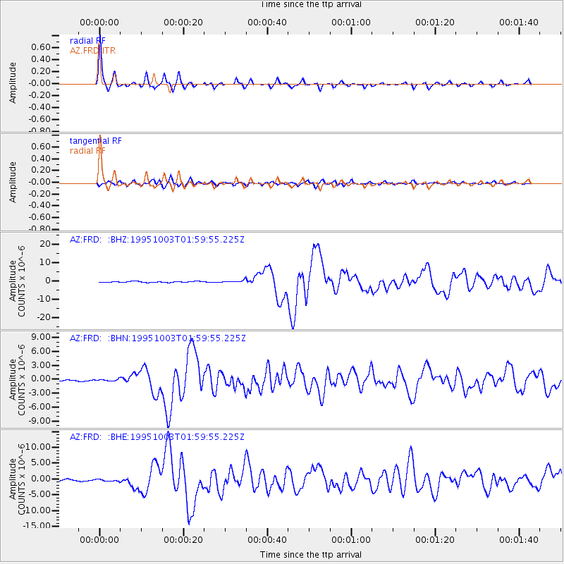
Earthquake location: Peru-Ecuador Border Region
Earthquake latitude/longitude: -2.8/-77.9
Earthquake time(UTC): 1995/10/03 (276) 01:51:24 GMT
Earthquake Depth: 27 km
Earthquake Magnitude: 6.5 MB, 7.0 MS, 6.9 UNKNOWN, 7.0 MW
Earthquake Catalog/Contributor: WHDF/NEIC
Network: AZ ANZA Regional Network
Station: FRD AZ.FRD
Lat/Lon: 33.49 N/116.60 W
Elevation: 1164 m
Distance: 51.3 deg
Az: 317.975 deg
Baz: 126.85 deg
Ray Param: 0.067438595
Estimated Moho Depth: 26.5 km
Estimated Crust Vp/Vs: 1.82
Assumed Crust Vp: 6.264 km/s
Estimated Crust Vs: 3.451 km/s
Estimated Crust Poisson's Ratio: 0.28
Radial Match: 97.06062 %
Radial Bump: 306
Transverse Match: 81.636444 %
Transverse Bump: 400
SOD ConfigId: 6273
Insert Time: 2010-02-26 19:14:11.297 +0000
GWidth: 2.5
Max Bumps: 400
Tol: 0.001

Signal To Noise

ChannelStoNSTALTA
AZ:FRD: :BHN:19951003T01:59:55.225Z1.54244642.0130207E-71.3050831E-7
AZ:FRD: :BHE:19951003T01:59:55.225Z1.14451533.1258693E-72.7311728E-7
AZ:FRD: :BHZ:19951003T01:59:55.225Z2.45370986.4502603E-72.628779E-7
Arrivals
Ps3.6 SECOND
PpPs11 SECOND
PsPs/PpSs15 SECOND