You are here: Home > Network List > TA - USArray Transportable Network (new EarthScope stations) Stations List
> Station H33A Prehn Over North, Clear Lake, SD, USA > Earthquake Result Viewer
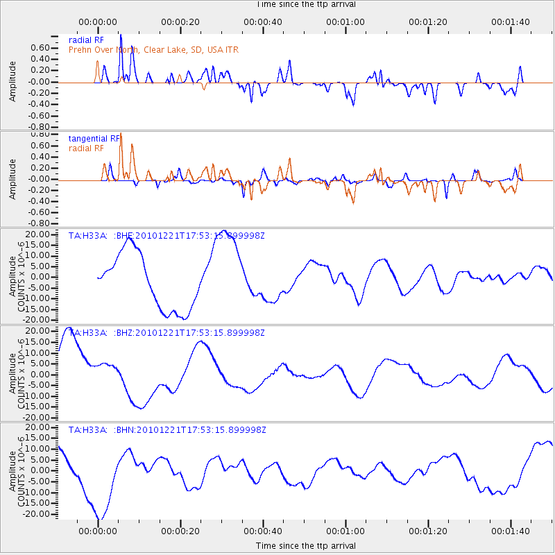
H33A Prehn Over North, Clear Lake, SD, USA - Earthquake Result Viewer
*The percent match for this event was below the threshold and hence no stack was calculated.
| Earthquake location: |
Bonin Islands, Japan Region |
| Earthquake latitude/longitude: |
27.1/143.2 |
| Earthquake time(UTC): |
2010/12/21 (355) 17:40:47 GMT |
| Earthquake Depth: |
10 km |
| Earthquake Magnitude: |
5.5 MB |
| Earthquake Catalog/Contributor: |
WHDF/NEIC |
|
| Network: |
TA USArray Transportable Network (new EarthScope stations) |
| Station: |
H33A Prehn Over North, Clear Lake, SD, USA |
| Lat/Lon: |
44.68 N/96.74 W |
| Elevation: |
584 m |
|
| Distance: |
90.1 deg |
| Az: |
38.138 deg |
| Baz: |
309.482 deg |
| Ray Param: |
$rayparam |
*The percent match for this event was below the threshold and hence was not used in the summary stack. |
|
| Radial Match: |
69.66262 % |
| Radial Bump: |
400 |
| Transverse Match: |
71.0445 % |
| Transverse Bump: |
324 |
| SOD ConfigId: |
346175 |
| Insert Time: |
2011-05-24 21:16:32.702 +0000 |
| GWidth: |
2.5 |
| Max Bumps: |
400 |
| Tol: |
0.001 |
|
Signal To Noise
| Channel | StoN | STA | LTA |
| TA:H33A: :BHZ:20101221T17:53:15.899998Z | 0.48920125 | 5.5975015E-6 | 1.1442125E-5 |
| TA:H33A: :BHN:20101221T17:53:15.899998Z | 1.9012926 | 1.813207E-5 | 9.536708E-6 |
| TA:H33A: :BHE:20101221T17:53:15.899998Z | 1.6410793 | 2.0867476E-5 | 1.2715702E-5 |
| Arrivals |
| Ps | |
| PpPs | |
| PsPs/PpSs | |


