You are here: Home > Network List > TA - USArray Transportable Network (new EarthScope stations) Stations List
> Station C06D Leavenworth, WQ, USA > Earthquake Result Viewer
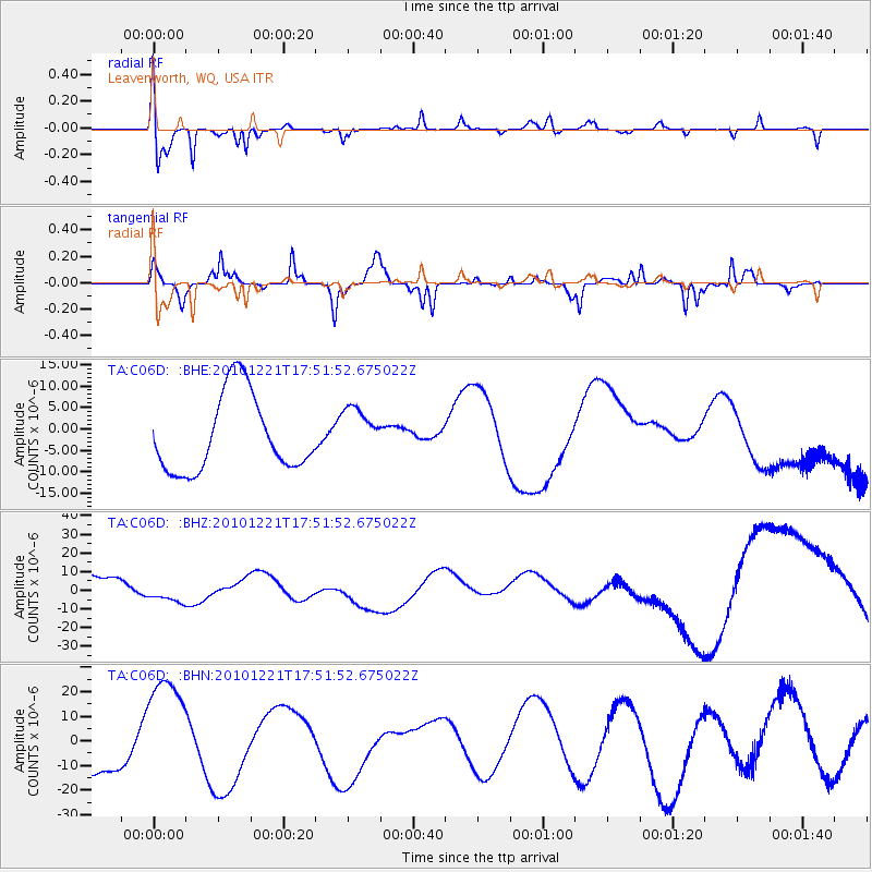
C06D Leavenworth, WQ, USA - Earthquake Result Viewer
*The percent match for this event was below the threshold and hence no stack was calculated.
| Earthquake location: |
Bonin Islands, Japan Region |
| Earthquake latitude/longitude: |
27.1/143.2 |
| Earthquake time(UTC): |
2010/12/21 (355) 17:40:47 GMT |
| Earthquake Depth: |
10 km |
| Earthquake Magnitude: |
5.5 MB |
| Earthquake Catalog/Contributor: |
WHDF/NEIC |
|
| Network: |
TA USArray Transportable Network (new EarthScope stations) |
| Station: |
C06D Leavenworth, WQ, USA |
| Lat/Lon: |
47.92 N/120.89 W |
| Elevation: |
544 m |
|
| Distance: |
74.1 deg |
| Az: |
44.074 deg |
| Baz: |
292.77 deg |
| Ray Param: |
$rayparam |
*The percent match for this event was below the threshold and hence was not used in the summary stack. |
|
| Radial Match: |
68.03891 % |
| Radial Bump: |
400 |
| Transverse Match: |
41.324905 % |
| Transverse Bump: |
231 |
| SOD ConfigId: |
346175 |
| Insert Time: |
2011-05-24 21:22:29.046 +0000 |
| GWidth: |
2.5 |
| Max Bumps: |
400 |
| Tol: |
0.001 |
|
Signal To Noise
| Channel | StoN | STA | LTA |
| TA:C06D: :BHZ:20101221T17:51:52.675022Z | 0.6306669 | 4.560188E-6 | 7.2307384E-6 |
| TA:C06D: :BHN:20101221T17:51:52.675022Z | 2.379571 | 2.3162333E-5 | 9.733827E-6 |
| TA:C06D: :BHE:20101221T17:51:52.675022Z | 0.6556539 | 5.8358128E-6 | 8.900753E-6 |
| Arrivals |
| Ps | |
| PpPs | |
| PsPs/PpSs | |


