You are here: Home > Network List > TA - USArray Transportable Network (new EarthScope stations) Stations List
> Station H37A Dierke Farm, Cannon Falls, MN, USA > Earthquake Result Viewer
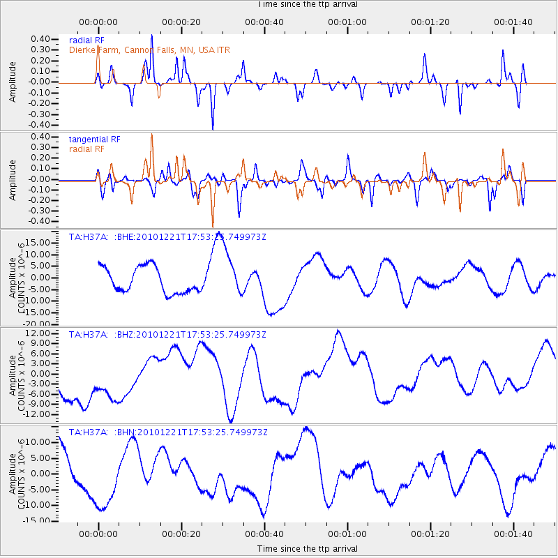
H37A Dierke Farm, Cannon Falls, MN, USA - Earthquake Result Viewer
*The percent match for this event was below the threshold and hence no stack was calculated.
| Earthquake location: |
Bonin Islands, Japan Region |
| Earthquake latitude/longitude: |
27.1/143.2 |
| Earthquake time(UTC): |
2010/12/21 (355) 17:40:47 GMT |
| Earthquake Depth: |
10 km |
| Earthquake Magnitude: |
5.5 MB |
| Earthquake Catalog/Contributor: |
WHDF/NEIC |
|
| Network: |
TA USArray Transportable Network (new EarthScope stations) |
| Station: |
H37A Dierke Farm, Cannon Falls, MN, USA |
| Lat/Lon: |
44.58 N/92.92 W |
| Elevation: |
321 m |
|
| Distance: |
92.2 deg |
| Az: |
36.427 deg |
| Baz: |
312.194 deg |
| Ray Param: |
$rayparam |
*The percent match for this event was below the threshold and hence was not used in the summary stack. |
|
| Radial Match: |
55.571175 % |
| Radial Bump: |
289 |
| Transverse Match: |
42.842083 % |
| Transverse Bump: |
362 |
| SOD ConfigId: |
346175 |
| Insert Time: |
2011-05-24 21:26:17.262 +0000 |
| GWidth: |
2.5 |
| Max Bumps: |
400 |
| Tol: |
0.001 |
|
Signal To Noise
| Channel | StoN | STA | LTA |
| TA:H37A: :BHZ:20101221T17:53:25.749973Z | 1.24196 | 7.6551705E-6 | 6.1637816E-6 |
| TA:H37A: :BHN:20101221T17:53:25.749973Z | 1.6870117 | 9.461642E-6 | 5.608522E-6 |
| TA:H37A: :BHE:20101221T17:53:25.749973Z | 2.1859531 | 1.1787793E-5 | 5.3925187E-6 |
| Arrivals |
| Ps | |
| PpPs | |
| PsPs/PpSs | |


