You are here: Home > Network List > TA - USArray Transportable Network (new EarthScope stations) Stations List
> Station I37A Lemond, Waseca, MN, USA > Earthquake Result Viewer
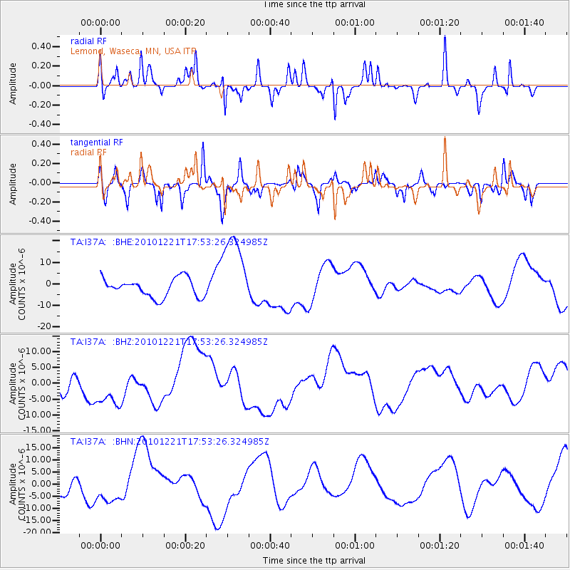
I37A Lemond, Waseca, MN, USA - Earthquake Result Viewer
*The percent match for this event was below the threshold and hence no stack was calculated.
| Earthquake location: |
Bonin Islands, Japan Region |
| Earthquake latitude/longitude: |
27.1/143.2 |
| Earthquake time(UTC): |
2010/12/21 (355) 17:40:47 GMT |
| Earthquake Depth: |
10 km |
| Earthquake Magnitude: |
5.5 MB |
| Earthquake Catalog/Contributor: |
WHDF/NEIC |
|
| Network: |
TA USArray Transportable Network (new EarthScope stations) |
| Station: |
I37A Lemond, Waseca, MN, USA |
| Lat/Lon: |
44.01 N/93.40 W |
| Elevation: |
371 m |
|
| Distance: |
92.3 deg |
| Az: |
37.08 deg |
| Baz: |
311.833 deg |
| Ray Param: |
$rayparam |
*The percent match for this event was below the threshold and hence was not used in the summary stack. |
|
| Radial Match: |
40.379147 % |
| Radial Bump: |
239 |
| Transverse Match: |
62.478134 % |
| Transverse Bump: |
385 |
| SOD ConfigId: |
346175 |
| Insert Time: |
2011-05-24 21:28:34.271 +0000 |
| GWidth: |
2.5 |
| Max Bumps: |
400 |
| Tol: |
0.001 |
|
Signal To Noise
| Channel | StoN | STA | LTA |
| TA:I37A: :BHZ:20101221T17:53:26.324985Z | 1.720802 | 6.9008124E-6 | 4.0102304E-6 |
| TA:I37A: :BHN:20101221T17:53:26.324985Z | 1.19762 | 6.5616655E-6 | 5.4789207E-6 |
| TA:I37A: :BHE:20101221T17:53:26.324985Z | 4.2034526 | 1.8023242E-5 | 4.2877236E-6 |
| Arrivals |
| Ps | |
| PpPs | |
| PsPs/PpSs | |


