You are here: Home > Network List > CI - Caltech Regional Seismic Network Stations List
> Station FUR Furnace Creek, CA, USA > Earthquake Result Viewer
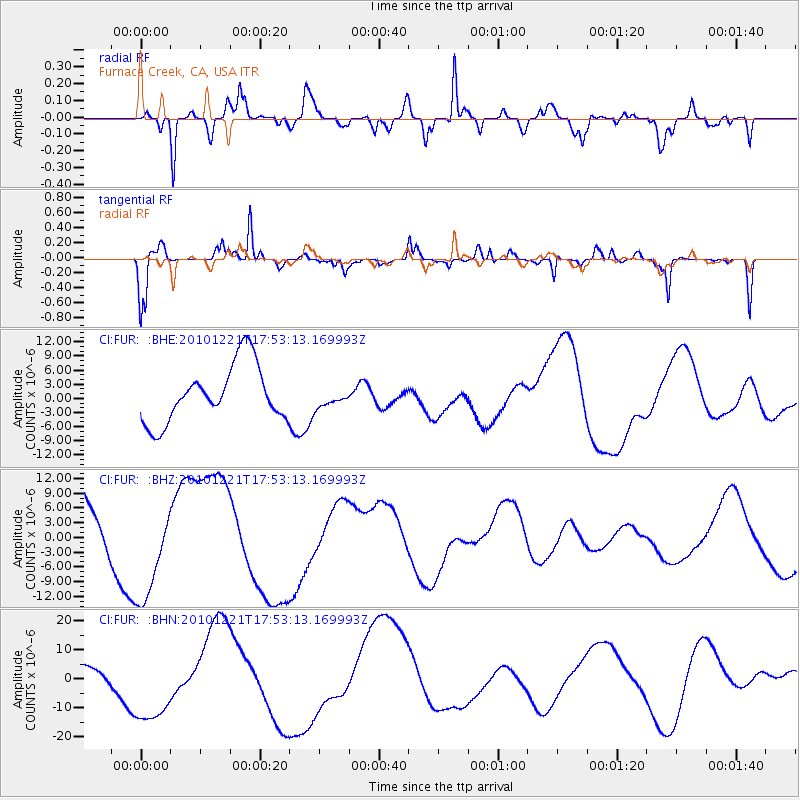
FUR Furnace Creek, CA, USA - Earthquake Result Viewer
*The percent match for this event was below the threshold and hence no stack was calculated.
| Earthquake location: |
Bonin Islands, Japan Region |
| Earthquake latitude/longitude: |
27.1/143.3 |
| Earthquake time(UTC): |
2010/12/21 (355) 17:41:25 GMT |
| Earthquake Depth: |
7.6 km |
| Earthquake Magnitude: |
5.5 MB |
| Earthquake Catalog/Contributor: |
WHDF/NEIC |
|
| Network: |
CI Caltech Regional Seismic Network |
| Station: |
FUR Furnace Creek, CA, USA |
| Lat/Lon: |
36.47 N/116.86 W |
| Elevation: |
-37.0 m |
|
| Distance: |
81.6 deg |
| Az: |
53.397 deg |
| Baz: |
297.385 deg |
| Ray Param: |
$rayparam |
*The percent match for this event was below the threshold and hence was not used in the summary stack. |
|
| Radial Match: |
64.368 % |
| Radial Bump: |
400 |
| Transverse Match: |
79.0744 % |
| Transverse Bump: |
304 |
| SOD ConfigId: |
346175 |
| Insert Time: |
2011-05-24 21:50:59.510 +0000 |
| GWidth: |
2.5 |
| Max Bumps: |
400 |
| Tol: |
0.001 |
|
Signal To Noise
| Channel | StoN | STA | LTA |
| CI:FUR: :BHZ:20101221T17:53:13.169993Z | 1.2525295 | 9.841284E-6 | 7.857127E-6 |
| CI:FUR: :BHN:20101221T17:53:13.169993Z | 2.7597961 | 1.4425313E-5 | 5.2269484E-6 |
| CI:FUR: :BHE:20101221T17:53:13.169993Z | 0.33238378 | 1.9915024E-6 | 5.991575E-6 |
| Arrivals |
| Ps | |
| PpPs | |
| PsPs/PpSs | |


