You are here: Home > Network List > CI - Caltech Regional Seismic Network Stations List
> Station MPM Manuel Prospect Mine, California, USA > Earthquake Result Viewer
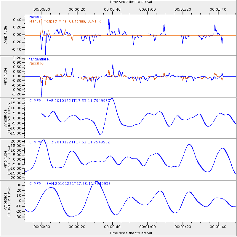
MPM Manuel Prospect Mine, California, USA - Earthquake Result Viewer
*The percent match for this event was below the threshold and hence no stack was calculated.
| Earthquake location: |
Bonin Islands, Japan Region |
| Earthquake latitude/longitude: |
27.1/143.3 |
| Earthquake time(UTC): |
2010/12/21 (355) 17:41:25 GMT |
| Earthquake Depth: |
7.6 km |
| Earthquake Magnitude: |
5.5 MB |
| Earthquake Catalog/Contributor: |
WHDF/NEIC |
|
| Network: |
CI Caltech Regional Seismic Network |
| Station: |
MPM Manuel Prospect Mine, California, USA |
| Lat/Lon: |
36.06 N/117.49 W |
| Elevation: |
185 m |
|
| Distance: |
81.4 deg |
| Az: |
53.998 deg |
| Baz: |
297.106 deg |
| Ray Param: |
$rayparam |
*The percent match for this event was below the threshold and hence was not used in the summary stack. |
|
| Radial Match: |
78.43671 % |
| Radial Bump: |
234 |
| Transverse Match: |
65.261475 % |
| Transverse Bump: |
293 |
| SOD ConfigId: |
346175 |
| Insert Time: |
2011-05-24 21:51:37.480 +0000 |
| GWidth: |
2.5 |
| Max Bumps: |
400 |
| Tol: |
0.001 |
|
Signal To Noise
| Channel | StoN | STA | LTA |
| CI:MPM: :BHZ:20101221T17:53:11.794993Z | 2.4492803 | 1.8670144E-5 | 7.6227057E-6 |
| CI:MPM: :BHN:20101221T17:53:11.794993Z | 2.1370268 | 2.0542857E-5 | 9.6128215E-6 |
| CI:MPM: :BHE:20101221T17:53:11.794993Z | 4.5773945 | 1.2721618E-5 | 2.779227E-6 |
| Arrivals |
| Ps | |
| PpPs | |
| PsPs/PpSs | |


