You are here: Home > Network List > CI - Caltech Regional Seismic Network Stations List
> Station SLA SLA, Trona, CA, USA > Earthquake Result Viewer
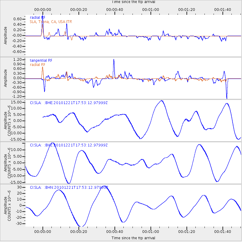
SLA SLA, Trona, CA, USA - Earthquake Result Viewer
*The percent match for this event was below the threshold and hence no stack was calculated.
| Earthquake location: |
Bonin Islands, Japan Region |
| Earthquake latitude/longitude: |
27.1/143.3 |
| Earthquake time(UTC): |
2010/12/21 (355) 17:41:25 GMT |
| Earthquake Depth: |
7.6 km |
| Earthquake Magnitude: |
5.5 MB |
| Earthquake Catalog/Contributor: |
WHDF/NEIC |
|
| Network: |
CI Caltech Regional Seismic Network |
| Station: |
SLA SLA, Trona, CA, USA |
| Lat/Lon: |
35.89 N/117.28 W |
| Elevation: |
1174 m |
|
| Distance: |
81.6 deg |
| Az: |
54.071 deg |
| Baz: |
297.237 deg |
| Ray Param: |
$rayparam |
*The percent match for this event was below the threshold and hence was not used in the summary stack. |
|
| Radial Match: |
70.733635 % |
| Radial Bump: |
400 |
| Transverse Match: |
51.546684 % |
| Transverse Bump: |
355 |
| SOD ConfigId: |
346175 |
| Insert Time: |
2011-05-24 21:52:26.875 +0000 |
| GWidth: |
2.5 |
| Max Bumps: |
400 |
| Tol: |
0.001 |
|
Signal To Noise
| Channel | StoN | STA | LTA |
| CI:SLA: :BHZ:20101221T17:53:12.97999Z | 1.9344518 | 9.3479575E-6 | 4.832355E-6 |
| CI:SLA: :BHN:20101221T17:53:12.97999Z | 1.6373727 | 7.5136086E-6 | 4.5888196E-6 |
| CI:SLA: :BHE:20101221T17:53:12.97999Z | 1.057517 | 4.275948E-6 | 4.0433847E-6 |
| Arrivals |
| Ps | |
| PpPs | |
| PsPs/PpSs | |


