You are here: Home > Network List > TA - USArray Transportable Network (new EarthScope stations) Stations List
> Station E62A Clayton Lake, ME, USA > Earthquake Result Viewer
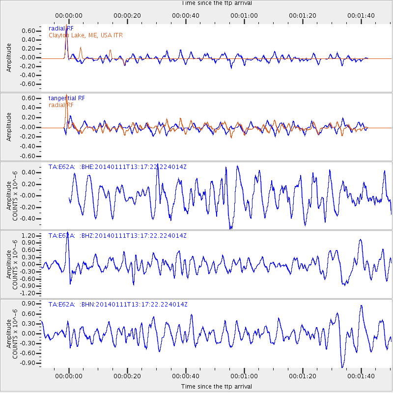
E62A Clayton Lake, ME, USA - Earthquake Result Viewer
*The percent match for this event was below the threshold and hence no stack was calculated.
| Earthquake location: |
Near Coast Of Chiapas, Mexico |
| Earthquake latitude/longitude: |
14.6/-92.1 |
| Earthquake time(UTC): |
2014/01/11 (011) 13:10:51 GMT |
| Earthquake Depth: |
78 km |
| Earthquake Magnitude: |
5.5 MWB, 5.7 MWC |
| Earthquake Catalog/Contributor: |
NEIC PDE/NEIC COMCAT |
|
| Network: |
TA USArray Transportable Network (new EarthScope stations) |
| Station: |
E62A Clayton Lake, ME, USA |
| Lat/Lon: |
46.62 N/69.52 W |
| Elevation: |
356 m |
|
| Distance: |
37.0 deg |
| Az: |
26.013 deg |
| Baz: |
218.016 deg |
| Ray Param: |
$rayparam |
*The percent match for this event was below the threshold and hence was not used in the summary stack. |
|
| Radial Match: |
66.88278 % |
| Radial Bump: |
320 |
| Transverse Match: |
55.16654 % |
| Transverse Bump: |
400 |
| SOD ConfigId: |
3390531 |
| Insert Time: |
2019-04-09 23:33:58.706 +0000 |
| GWidth: |
2.5 |
| Max Bumps: |
400 |
| Tol: |
0.001 |
|
Signal To Noise
| Channel | StoN | STA | LTA |
| TA:E62A: :BHZ:20140111T13:17:22.224014Z | 2.9733639 | 5.4383327E-7 | 1.8290167E-7 |
| TA:E62A: :BHN:20140111T13:17:22.224014Z | 1.3685368 | 2.3073949E-7 | 1.6860305E-7 |
| TA:E62A: :BHE:20140111T13:17:22.224014Z | 1.3843768 | 2.5547595E-7 | 1.845422E-7 |
| Arrivals |
| Ps | |
| PpPs | |
| PsPs/PpSs | |


