You are here: Home > Network List > TA - USArray Transportable Network (new EarthScope stations) Stations List
> Station G47A Hillman, MI, USA > Earthquake Result Viewer
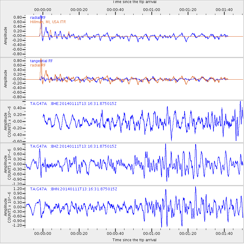
G47A Hillman, MI, USA - Earthquake Result Viewer
*The percent match for this event was below the threshold and hence no stack was calculated.
| Earthquake location: |
Near Coast Of Chiapas, Mexico |
| Earthquake latitude/longitude: |
14.6/-92.1 |
| Earthquake time(UTC): |
2014/01/11 (011) 13:10:51 GMT |
| Earthquake Depth: |
78 km |
| Earthquake Magnitude: |
5.5 MWB, 5.7 MWC |
| Earthquake Catalog/Contributor: |
NEIC PDE/NEIC COMCAT |
|
| Network: |
TA USArray Transportable Network (new EarthScope stations) |
| Station: |
G47A Hillman, MI, USA |
| Lat/Lon: |
45.17 N/83.86 W |
| Elevation: |
239 m |
|
| Distance: |
31.2 deg |
| Az: |
11.231 deg |
| Baz: |
195.458 deg |
| Ray Param: |
$rayparam |
*The percent match for this event was below the threshold and hence was not used in the summary stack. |
|
| Radial Match: |
72.96513 % |
| Radial Bump: |
400 |
| Transverse Match: |
56.34665 % |
| Transverse Bump: |
400 |
| SOD ConfigId: |
3390531 |
| Insert Time: |
2019-04-09 23:34:01.834 +0000 |
| GWidth: |
2.5 |
| Max Bumps: |
400 |
| Tol: |
0.001 |
|
Signal To Noise
| Channel | StoN | STA | LTA |
| TA:G47A: :BHZ:20140111T13:16:31.875015Z | 1.2678838 | 2.1783302E-7 | 1.7180834E-7 |
| TA:G47A: :BHN:20140111T13:16:31.875015Z | 1.8143032 | 2.9837943E-7 | 1.6445954E-7 |
| TA:G47A: :BHE:20140111T13:16:31.875015Z | 1.115496 | 1.2892532E-7 | 1.15576675E-7 |
| Arrivals |
| Ps | |
| PpPs | |
| PsPs/PpSs | |


