You are here: Home > Network List > CI - Caltech Regional Seismic Network Stations List
> Station EDW2 EDW2, Mojave, CA, USA > Earthquake Result Viewer
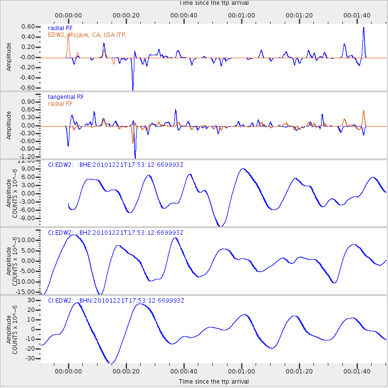
EDW2 EDW2, Mojave, CA, USA - Earthquake Result Viewer
*The percent match for this event was below the threshold and hence no stack was calculated.
| Earthquake location: |
Bonin Islands, Japan Region |
| Earthquake latitude/longitude: |
27.1/143.3 |
| Earthquake time(UTC): |
2010/12/21 (355) 17:41:25 GMT |
| Earthquake Depth: |
7.6 km |
| Earthquake Magnitude: |
5.5 MB |
| Earthquake Catalog/Contributor: |
WHDF/NEIC |
|
| Network: |
CI Caltech Regional Seismic Network |
| Station: |
EDW2 EDW2, Mojave, CA, USA |
| Lat/Lon: |
34.88 N/117.99 W |
| Elevation: |
772 m |
|
| Distance: |
81.6 deg |
| Az: |
55.245 deg |
| Baz: |
296.999 deg |
| Ray Param: |
$rayparam |
*The percent match for this event was below the threshold and hence was not used in the summary stack. |
|
| Radial Match: |
58.868664 % |
| Radial Bump: |
258 |
| Transverse Match: |
71.24474 % |
| Transverse Bump: |
266 |
| SOD ConfigId: |
346175 |
| Insert Time: |
2011-05-24 21:55:38.472 +0000 |
| GWidth: |
2.5 |
| Max Bumps: |
400 |
| Tol: |
0.001 |
|
Signal To Noise
| Channel | StoN | STA | LTA |
| CI:EDW2: :BHZ:20101221T17:53:12.669993Z | 1.9369899 | 1.460889E-5 | 7.5420576E-6 |
| CI:EDW2: :BHN:20101221T17:53:12.669993Z | 2.8541372 | 2.2986595E-5 | 8.05378E-6 |
| CI:EDW2: :BHE:20101221T17:53:12.669993Z | 0.93172306 | 3.770547E-6 | 4.046854E-6 |
| Arrivals |
| Ps | |
| PpPs | |
| PsPs/PpSs | |


