You are here: Home > Network List > KN - Kyrgyz Seismic Telemetry Network Stations List
> Station TKM2 KN.TKM2 > Earthquake Result Viewer
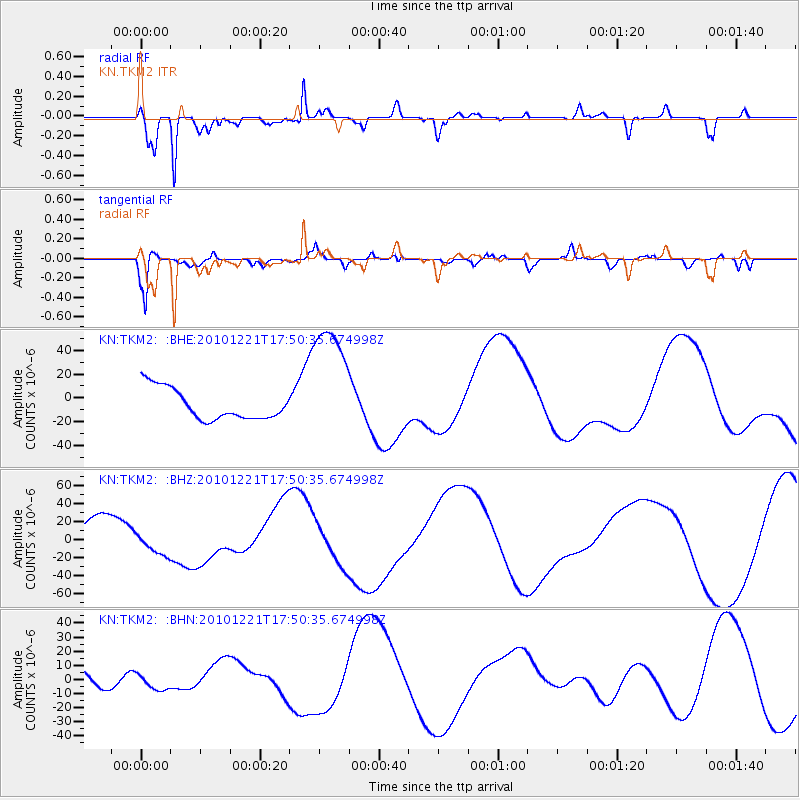
TKM2 KN.TKM2 - Earthquake Result Viewer
*The percent match for this event was below the threshold and hence no stack was calculated.
| Earthquake location: |
Bonin Islands, Japan Region |
| Earthquake latitude/longitude: |
27.1/143.3 |
| Earthquake time(UTC): |
2010/12/21 (355) 17:41:25 GMT |
| Earthquake Depth: |
7.6 km |
| Earthquake Magnitude: |
5.5 MB |
| Earthquake Catalog/Contributor: |
WHDF/NEIC |
|
| Network: |
KN Kyrgyz Seismic Telemetry Network |
| Station: |
TKM2 KN.TKM2 |
| Lat/Lon: |
42.92 N/75.60 E |
| Elevation: |
2020 m |
|
| Distance: |
56.2 deg |
| Az: |
305.163 deg |
| Baz: |
82.871 deg |
| Ray Param: |
$rayparam |
*The percent match for this event was below the threshold and hence was not used in the summary stack. |
|
| Radial Match: |
84.48163 % |
| Radial Bump: |
364 |
| Transverse Match: |
69.07627 % |
| Transverse Bump: |
368 |
| SOD ConfigId: |
346175 |
| Insert Time: |
2011-05-24 21:59:15.199 +0000 |
| GWidth: |
2.5 |
| Max Bumps: |
400 |
| Tol: |
0.001 |
|
Signal To Noise
| Channel | StoN | STA | LTA |
| KN:TKM2: :BHZ:20101221T17:50:35.674998Z | 0.6824975 | 1.1509166E-5 | 1.6863309E-5 |
| KN:TKM2: :BHN:20101221T17:50:35.674998Z | 0.8326531 | 5.8198875E-6 | 6.9895705E-6 |
| KN:TKM2: :BHE:20101221T17:50:35.674998Z | 4.2064495 | 5.4610864E-5 | 1.298265E-5 |
| Arrivals |
| Ps | |
| PpPs | |
| PsPs/PpSs | |


