You are here: Home > Network List > TA - USArray Transportable Network (new EarthScope stations) Stations List
> Station 332A Millersview, TX, USA > Earthquake Result Viewer
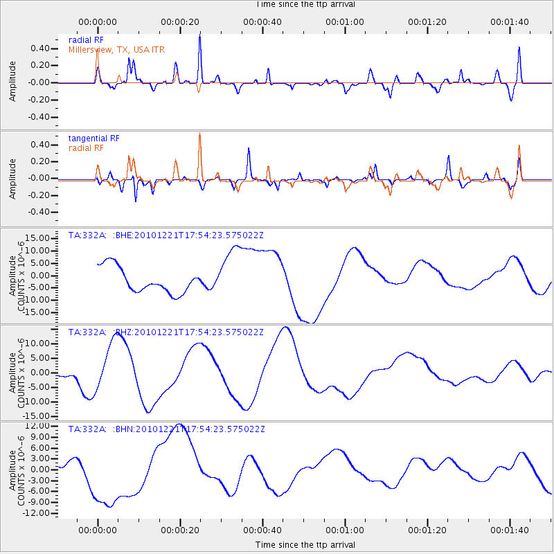
332A Millersview, TX, USA - Earthquake Result Viewer
*The percent match for this event was below the threshold and hence no stack was calculated.
| Earthquake location: |
Bonin Islands, Japan Region |
| Earthquake latitude/longitude: |
27.1/143.3 |
| Earthquake time(UTC): |
2010/12/21 (355) 17:41:25 GMT |
| Earthquake Depth: |
7.6 km |
| Earthquake Magnitude: |
5.5 MB |
| Earthquake Catalog/Contributor: |
WHDF/NEIC |
|
| Network: |
TA USArray Transportable Network (new EarthScope stations) |
| Station: |
332A Millersview, TX, USA |
| Lat/Lon: |
31.38 N/99.74 W |
| Elevation: |
513 m |
|
| Distance: |
96.4 deg |
| Az: |
50.095 deg |
| Baz: |
306.898 deg |
| Ray Param: |
$rayparam |
*The percent match for this event was below the threshold and hence was not used in the summary stack. |
|
| Radial Match: |
29.392157 % |
| Radial Bump: |
251 |
| Transverse Match: |
66.49539 % |
| Transverse Bump: |
335 |
| SOD ConfigId: |
346175 |
| Insert Time: |
2011-05-24 22:07:44.121 +0000 |
| GWidth: |
2.5 |
| Max Bumps: |
400 |
| Tol: |
0.001 |
|
Signal To Noise
| Channel | StoN | STA | LTA |
| TA:332A: :BHZ:20101221T17:54:23.575022Z | 4.398843 | 8.468962E-6 | 1.9252702E-6 |
| TA:332A: :BHN:20101221T17:54:23.575022Z | 2.6742063 | 1.039571E-5 | 3.8874E-6 |
| TA:332A: :BHE:20101221T17:54:23.575022Z | 2.1707163 | 1.1026796E-5 | 5.0797958E-6 |
| Arrivals |
| Ps | |
| PpPs | |
| PsPs/PpSs | |


