You are here: Home > Network List > TA - USArray Transportable Network (new EarthScope stations) Stations List
> Station X36A Centrahoma, OK, USA > Earthquake Result Viewer
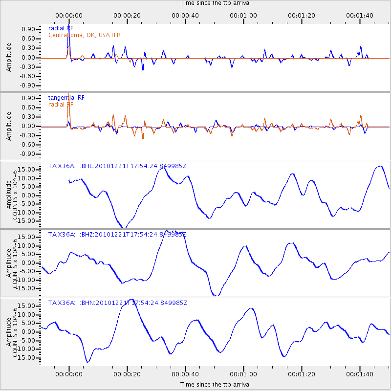
X36A Centrahoma, OK, USA - Earthquake Result Viewer
*The percent match for this event was below the threshold and hence no stack was calculated.
| Earthquake location: |
Bonin Islands, Japan Region |
| Earthquake latitude/longitude: |
27.1/143.3 |
| Earthquake time(UTC): |
2010/12/21 (355) 17:41:25 GMT |
| Earthquake Depth: |
7.6 km |
| Earthquake Magnitude: |
5.5 MB |
| Earthquake Catalog/Contributor: |
WHDF/NEIC |
|
| Network: |
TA USArray Transportable Network (new EarthScope stations) |
| Station: |
X36A Centrahoma, OK, USA |
| Lat/Lon: |
34.57 N/96.35 W |
| Elevation: |
211 m |
|
| Distance: |
96.7 deg |
| Az: |
45.809 deg |
| Baz: |
309.222 deg |
| Ray Param: |
$rayparam |
*The percent match for this event was below the threshold and hence was not used in the summary stack. |
|
| Radial Match: |
45.903343 % |
| Radial Bump: |
367 |
| Transverse Match: |
20.999083 % |
| Transverse Bump: |
400 |
| SOD ConfigId: |
346175 |
| Insert Time: |
2011-05-24 22:25:50.597 +0000 |
| GWidth: |
2.5 |
| Max Bumps: |
400 |
| Tol: |
0.001 |
|
Signal To Noise
| Channel | StoN | STA | LTA |
| TA:X36A: :BHZ:20101221T17:54:24.849985Z | 1.7304062 | 5.203278E-6 | 3.0069689E-6 |
| TA:X36A: :BHN:20101221T17:54:24.849985Z | 0.9303476 | 3.5092166E-6 | 3.7719412E-6 |
| TA:X36A: :BHE:20101221T17:54:24.849985Z | 1.7210848 | 1.629501E-5 | 9.467871E-6 |
| Arrivals |
| Ps | |
| PpPs | |
| PsPs/PpSs | |


