You are here: Home > Network List > TA - USArray Transportable Network (new EarthScope stations) Stations List
> Station T36A Boggs Farm, Caney, KS, USA > Earthquake Result Viewer
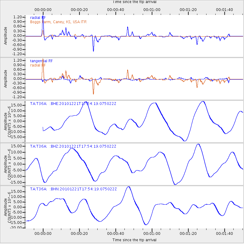
T36A Boggs Farm, Caney, KS, USA - Earthquake Result Viewer
*The percent match for this event was below the threshold and hence no stack was calculated.
| Earthquake location: |
Bonin Islands, Japan Region |
| Earthquake latitude/longitude: |
27.1/143.3 |
| Earthquake time(UTC): |
2010/12/21 (355) 17:41:25 GMT |
| Earthquake Depth: |
7.6 km |
| Earthquake Magnitude: |
5.5 MB |
| Earthquake Catalog/Contributor: |
WHDF/NEIC |
|
| Network: |
TA USArray Transportable Network (new EarthScope stations) |
| Station: |
T36A Boggs Farm, Caney, KS, USA |
| Lat/Lon: |
37.06 N/95.88 W |
| Elevation: |
243 m |
|
| Distance: |
95.4 deg |
| Az: |
43.634 deg |
| Baz: |
309.725 deg |
| Ray Param: |
$rayparam |
*The percent match for this event was below the threshold and hence was not used in the summary stack. |
|
| Radial Match: |
75.866135 % |
| Radial Bump: |
400 |
| Transverse Match: |
64.95034 % |
| Transverse Bump: |
400 |
| SOD ConfigId: |
346175 |
| Insert Time: |
2011-05-24 22:27:34.325 +0000 |
| GWidth: |
2.5 |
| Max Bumps: |
400 |
| Tol: |
0.001 |
|
Signal To Noise
| Channel | StoN | STA | LTA |
| TA:T36A: :BHZ:20101221T17:54:19.075022Z | 1.989272 | 1.1950031E-5 | 6.0072384E-6 |
| TA:T36A: :BHN:20101221T17:54:19.075022Z | 0.7049404 | 5.496423E-6 | 7.7970035E-6 |
| TA:T36A: :BHE:20101221T17:54:19.075022Z | 1.33513 | 1.1584871E-5 | 8.6769605E-6 |
| Arrivals |
| Ps | |
| PpPs | |
| PsPs/PpSs | |


