You are here: Home > Network List > TA - USArray Transportable Network (new EarthScope stations) Stations List
> Station O33A Hebron, NE, USA > Earthquake Result Viewer
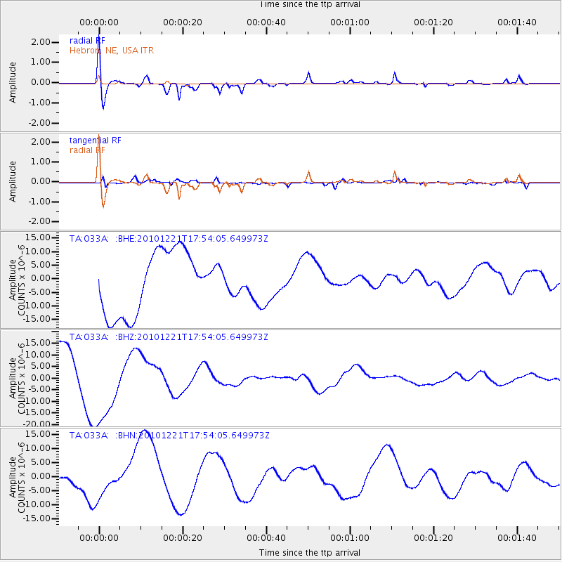
O33A Hebron, NE, USA - Earthquake Result Viewer
*The percent match for this event was below the threshold and hence no stack was calculated.
| Earthquake location: |
Bonin Islands, Japan Region |
| Earthquake latitude/longitude: |
27.1/143.3 |
| Earthquake time(UTC): |
2010/12/21 (355) 17:41:25 GMT |
| Earthquake Depth: |
7.6 km |
| Earthquake Magnitude: |
5.5 MB |
| Earthquake Catalog/Contributor: |
WHDF/NEIC |
|
| Network: |
TA USArray Transportable Network (new EarthScope stations) |
| Station: |
O33A Hebron, NE, USA |
| Lat/Lon: |
40.08 N/97.58 W |
| Elevation: |
480 m |
|
| Distance: |
92.4 deg |
| Az: |
42.146 deg |
| Baz: |
308.767 deg |
| Ray Param: |
$rayparam |
*The percent match for this event was below the threshold and hence was not used in the summary stack. |
|
| Radial Match: |
59.19059 % |
| Radial Bump: |
400 |
| Transverse Match: |
81.13968 % |
| Transverse Bump: |
400 |
| SOD ConfigId: |
346175 |
| Insert Time: |
2011-05-24 22:29:39.630 +0000 |
| GWidth: |
2.5 |
| Max Bumps: |
400 |
| Tol: |
0.001 |
|
Signal To Noise
| Channel | StoN | STA | LTA |
| TA:O33A: :BHZ:20101221T17:54:05.649973Z | 2.0631123 | 1.744799E-5 | 8.457121E-6 |
| TA:O33A: :BHN:20101221T17:54:05.649973Z | 0.799338 | 6.6560606E-6 | 8.326967E-6 |
| TA:O33A: :BHE:20101221T17:54:05.649973Z | 0.30566272 | 3.6216493E-6 | 1.1848514E-5 |
| Arrivals |
| Ps | |
| PpPs | |
| PsPs/PpSs | |


