You are here: Home > Network List > TA - USArray Transportable Network (new EarthScope stations) Stations List
> Station X38A Whitesboro, OK, USA > Earthquake Result Viewer
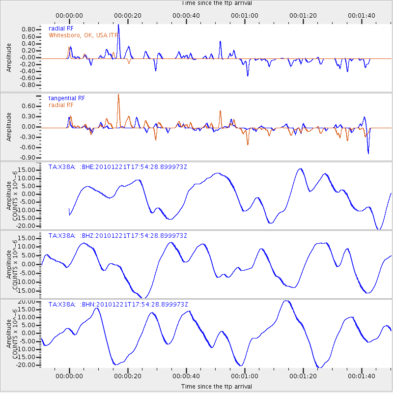
X38A Whitesboro, OK, USA - Earthquake Result Viewer
*The percent match for this event was below the threshold and hence no stack was calculated.
| Earthquake location: |
Bonin Islands, Japan Region |
| Earthquake latitude/longitude: |
27.1/143.3 |
| Earthquake time(UTC): |
2010/12/21 (355) 17:41:25 GMT |
| Earthquake Depth: |
7.6 km |
| Earthquake Magnitude: |
5.5 MB |
| Earthquake Catalog/Contributor: |
WHDF/NEIC |
|
| Network: |
TA USArray Transportable Network (new EarthScope stations) |
| Station: |
X38A Whitesboro, OK, USA |
| Lat/Lon: |
34.67 N/94.83 W |
| Elevation: |
234 m |
|
| Distance: |
97.6 deg |
| Az: |
44.924 deg |
| Baz: |
310.193 deg |
| Ray Param: |
$rayparam |
*The percent match for this event was below the threshold and hence was not used in the summary stack. |
|
| Radial Match: |
58.25202 % |
| Radial Bump: |
295 |
| Transverse Match: |
60.68448 % |
| Transverse Bump: |
400 |
| SOD ConfigId: |
346175 |
| Insert Time: |
2011-05-24 22:31:16.107 +0000 |
| GWidth: |
2.5 |
| Max Bumps: |
400 |
| Tol: |
0.001 |
|
Signal To Noise
| Channel | StoN | STA | LTA |
| TA:X38A: :BHZ:20101221T17:54:28.899973Z | 2.1679823 | 9.4413135E-6 | 4.354885E-6 |
| TA:X38A: :BHN:20101221T17:54:28.899973Z | 0.7038398 | 4.9038003E-6 | 6.967211E-6 |
| TA:X38A: :BHE:20101221T17:54:28.899973Z | 2.8448076 | 1.420618E-5 | 4.9937225E-6 |
| Arrivals |
| Ps | |
| PpPs | |
| PsPs/PpSs | |


