You are here: Home > Network List > TA - USArray Transportable Network (new EarthScope stations) Stations List
> Station L37A Phoenix Point, Boone, IA, USA > Earthquake Result Viewer
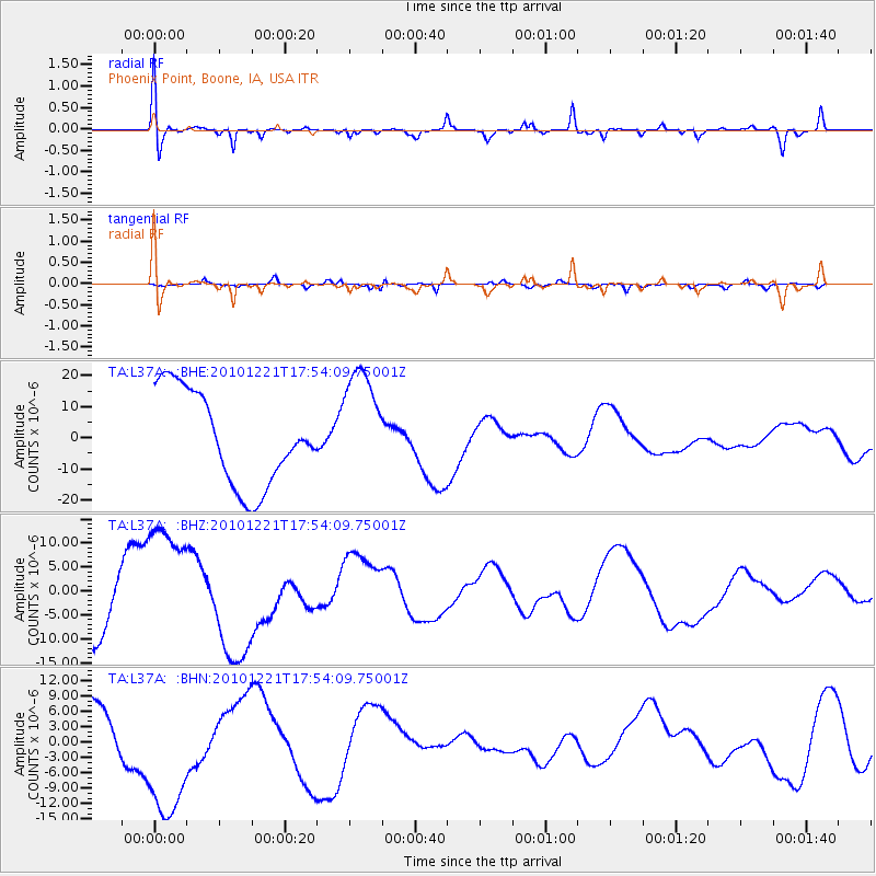
L37A Phoenix Point, Boone, IA, USA - Earthquake Result Viewer
*The percent match for this event was below the threshold and hence no stack was calculated.
| Earthquake location: |
Bonin Islands, Japan Region |
| Earthquake latitude/longitude: |
27.1/143.3 |
| Earthquake time(UTC): |
2010/12/21 (355) 17:41:25 GMT |
| Earthquake Depth: |
7.6 km |
| Earthquake Magnitude: |
5.5 MB |
| Earthquake Catalog/Contributor: |
WHDF/NEIC |
|
| Network: |
TA USArray Transportable Network (new EarthScope stations) |
| Station: |
L37A Phoenix Point, Boone, IA, USA |
| Lat/Lon: |
42.12 N/93.75 W |
| Elevation: |
312 m |
|
| Distance: |
93.3 deg |
| Az: |
38.712 deg |
| Baz: |
311.449 deg |
| Ray Param: |
$rayparam |
*The percent match for this event was below the threshold and hence was not used in the summary stack. |
|
| Radial Match: |
46.62393 % |
| Radial Bump: |
400 |
| Transverse Match: |
38.302265 % |
| Transverse Bump: |
263 |
| SOD ConfigId: |
346175 |
| Insert Time: |
2011-05-24 22:38:28.754 +0000 |
| GWidth: |
2.5 |
| Max Bumps: |
400 |
| Tol: |
0.001 |
|
Signal To Noise
| Channel | StoN | STA | LTA |
| TA:L37A: :BHZ:20101221T17:54:09.75001Z | 2.925479 | 1.4264021E-5 | 4.87579E-6 |
| TA:L37A: :BHN:20101221T17:54:09.75001Z | 1.8123894 | 1.3497185E-5 | 7.4471773E-6 |
| TA:L37A: :BHE:20101221T17:54:09.75001Z | 1.228861 | 1.8335519E-5 | 1.4920743E-5 |
| Arrivals |
| Ps | |
| PpPs | |
| PsPs/PpSs | |


