You are here: Home > Network List > US - United States National Seismic Network Stations List
> Station DUG Dugway, Tooele County, Utah, USA > Earthquake Result Viewer
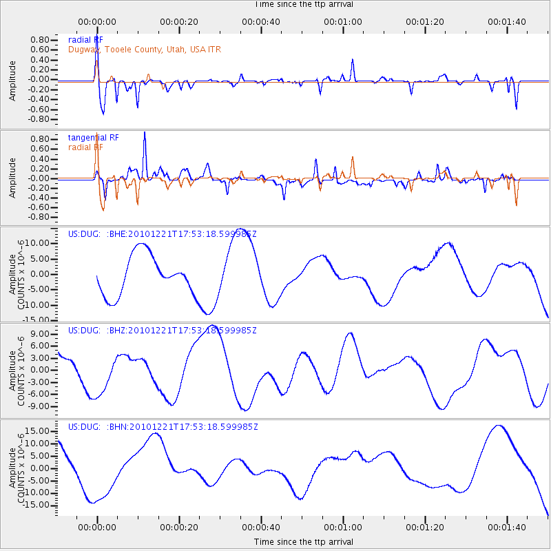
DUG Dugway, Tooele County, Utah, USA - Earthquake Result Viewer
*The percent match for this event was below the threshold and hence no stack was calculated.
| Earthquake location: |
Bonin Islands, Japan Region |
| Earthquake latitude/longitude: |
27.1/143.3 |
| Earthquake time(UTC): |
2010/12/21 (355) 17:41:25 GMT |
| Earthquake Depth: |
7.6 km |
| Earthquake Magnitude: |
5.5 MB |
| Earthquake Catalog/Contributor: |
WHDF/NEIC |
|
| Network: |
US United States National Seismic Network |
| Station: |
DUG Dugway, Tooele County, Utah, USA |
| Lat/Lon: |
40.19 N/112.81 W |
| Elevation: |
1477 m |
|
| Distance: |
82.7 deg |
| Az: |
48.566 deg |
| Baz: |
299.23 deg |
| Ray Param: |
$rayparam |
*The percent match for this event was below the threshold and hence was not used in the summary stack. |
|
| Radial Match: |
55.62783 % |
| Radial Bump: |
345 |
| Transverse Match: |
55.940624 % |
| Transverse Bump: |
390 |
| SOD ConfigId: |
346175 |
| Insert Time: |
2011-05-24 22:43:43.219 +0000 |
| GWidth: |
2.5 |
| Max Bumps: |
400 |
| Tol: |
0.001 |
|
Signal To Noise
| Channel | StoN | STA | LTA |
| US:DUG: :BHZ:20101221T17:53:18.599985Z | 1.1263713 | 5.4294865E-6 | 4.8203347E-6 |
| US:DUG: :BHN:20101221T17:53:18.599985Z | 2.142046 | 1.2379596E-5 | 5.7793327E-6 |
| US:DUG: :BHE:20101221T17:53:18.599985Z | 1.5548383 | 9.793933E-6 | 6.2990043E-6 |
| Arrivals |
| Ps | |
| PpPs | |
| PsPs/PpSs | |


