You are here: Home > Network List > US - United States National Seismic Network Stations List
> Station ELK Elko, Nevada, USA > Earthquake Result Viewer
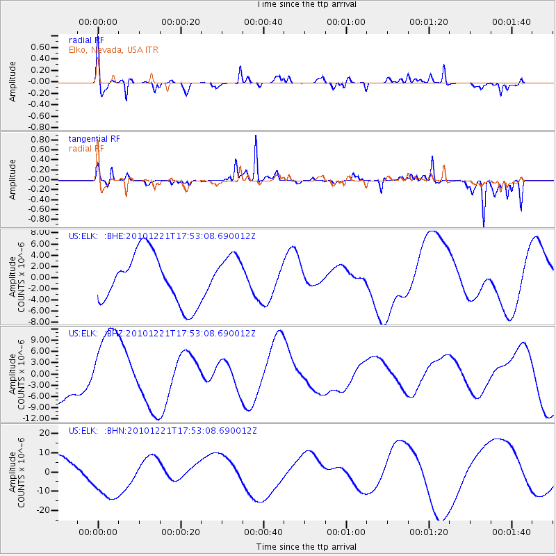
ELK Elko, Nevada, USA - Earthquake Result Viewer
*The percent match for this event was below the threshold and hence no stack was calculated.
| Earthquake location: |
Bonin Islands, Japan Region |
| Earthquake latitude/longitude: |
27.1/143.3 |
| Earthquake time(UTC): |
2010/12/21 (355) 17:41:25 GMT |
| Earthquake Depth: |
7.6 km |
| Earthquake Magnitude: |
5.5 MB |
| Earthquake Catalog/Contributor: |
WHDF/NEIC |
|
| Network: |
US United States National Seismic Network |
| Station: |
ELK Elko, Nevada, USA |
| Lat/Lon: |
40.74 N/115.24 W |
| Elevation: |
2210 m |
|
| Distance: |
80.8 deg |
| Az: |
48.97 deg |
| Baz: |
297.72 deg |
| Ray Param: |
$rayparam |
*The percent match for this event was below the threshold and hence was not used in the summary stack. |
|
| Radial Match: |
54.721992 % |
| Radial Bump: |
400 |
| Transverse Match: |
81.29504 % |
| Transverse Bump: |
287 |
| SOD ConfigId: |
346175 |
| Insert Time: |
2011-05-24 22:44:35.041 +0000 |
| GWidth: |
2.5 |
| Max Bumps: |
400 |
| Tol: |
0.001 |
|
Signal To Noise
| Channel | StoN | STA | LTA |
| US:ELK: :BHZ:20101221T17:53:08.690012Z | 1.7327654 | 1.09766615E-5 | 6.334765E-6 |
| US:ELK: :BHN:20101221T17:53:08.690012Z | 3.230392 | 1.3842376E-5 | 4.285045E-6 |
| US:ELK: :BHE:20101221T17:53:08.690012Z | 0.8842303 | 3.9916495E-6 | 4.514264E-6 |
| Arrivals |
| Ps | |
| PpPs | |
| PsPs/PpSs | |


