You are here: Home > Network List > US - United States National Seismic Network Stations List
> Station HDIL Hopedale, Illinois, USA > Earthquake Result Viewer
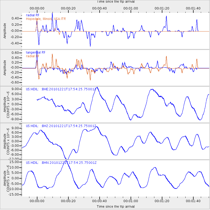
HDIL Hopedale, Illinois, USA - Earthquake Result Viewer
*The percent match for this event was below the threshold and hence no stack was calculated.
| Earthquake location: |
Bonin Islands, Japan Region |
| Earthquake latitude/longitude: |
27.1/143.3 |
| Earthquake time(UTC): |
2010/12/21 (355) 17:41:25 GMT |
| Earthquake Depth: |
7.6 km |
| Earthquake Magnitude: |
5.5 MB |
| Earthquake Catalog/Contributor: |
WHDF/NEIC |
|
| Network: |
US United States National Seismic Network |
| Station: |
HDIL Hopedale, Illinois, USA |
| Lat/Lon: |
40.56 N/89.29 W |
| Elevation: |
219 m |
|
| Distance: |
96.9 deg |
| Az: |
37.564 deg |
| Baz: |
314.487 deg |
| Ray Param: |
$rayparam |
*The percent match for this event was below the threshold and hence was not used in the summary stack. |
|
| Radial Match: |
53.24115 % |
| Radial Bump: |
302 |
| Transverse Match: |
57.53977 % |
| Transverse Bump: |
400 |
| SOD ConfigId: |
346175 |
| Insert Time: |
2011-05-24 22:46:16.228 +0000 |
| GWidth: |
2.5 |
| Max Bumps: |
400 |
| Tol: |
0.001 |
|
Signal To Noise
| Channel | StoN | STA | LTA |
| US:HDIL: :BHZ:20101221T17:54:25.75001Z | 3.3497791 | 7.851154E-6 | 2.3437824E-6 |
| US:HDIL: :BHN:20101221T17:54:25.75001Z | 1.0619425 | 6.9451453E-6 | 6.5400395E-6 |
| US:HDIL: :BHE:20101221T17:54:25.75001Z | 0.88287884 | 2.8866755E-6 | 3.2696169E-6 |
| Arrivals |
| Ps | |
| PpPs | |
| PsPs/PpSs | |


