You are here: Home > Network List > IC - New China Digital Seismograph Network Stations List
> Station ENH Enshi, Hubei Province, China > Earthquake Result Viewer
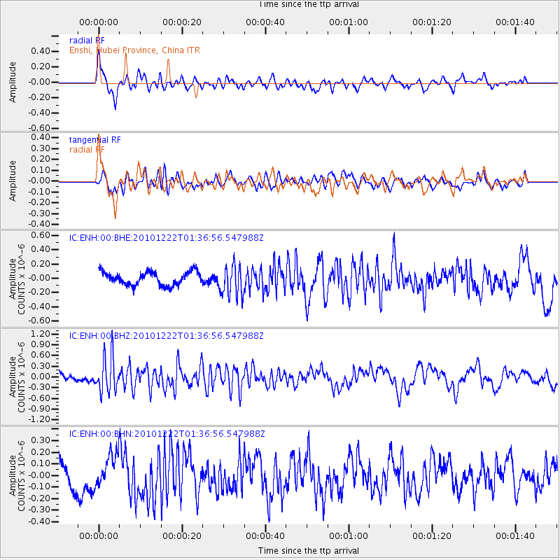
ENH Enshi, Hubei Province, China - Earthquake Result Viewer
*The percent match for this event was below the threshold and hence no stack was calculated.
| Earthquake location: |
Bonin Islands, Japan Region |
| Earthquake latitude/longitude: |
26.7/143.5 |
| Earthquake time(UTC): |
2010/12/22 (356) 01:31:17 GMT |
| Earthquake Depth: |
10 km |
| Earthquake Magnitude: |
5.5 MB, 5.2 MS, 5.6 MW |
| Earthquake Catalog/Contributor: |
WHDF/NEIC |
|
| Network: |
IC New China Digital Seismograph Network |
| Station: |
ENH Enshi, Hubei Province, China |
| Lat/Lon: |
30.28 N/109.49 E |
| Elevation: |
500 m |
|
| Distance: |
30.1 deg |
| Az: |
284.902 deg |
| Baz: |
88.372 deg |
| Ray Param: |
$rayparam |
*The percent match for this event was below the threshold and hence was not used in the summary stack. |
|
| Radial Match: |
77.58393 % |
| Radial Bump: |
400 |
| Transverse Match: |
46.500587 % |
| Transverse Bump: |
400 |
| SOD ConfigId: |
346175 |
| Insert Time: |
2011-05-24 23:13:52.593 +0000 |
| GWidth: |
2.5 |
| Max Bumps: |
400 |
| Tol: |
0.001 |
|
Signal To Noise
| Channel | StoN | STA | LTA |
| IC:ENH:00:BHZ:20101222T01:36:56.547988Z | 4.9115458 | 5.0737185E-7 | 1.0330187E-7 |
| IC:ENH:00:BHN:20101222T01:36:56.547988Z | 0.95195174 | 1.3617921E-7 | 1.4305265E-7 |
| IC:ENH:00:BHE:20101222T01:36:56.547988Z | 2.3381531 | 2.1915098E-7 | 9.372824E-8 |
| Arrivals |
| Ps | |
| PpPs | |
| PsPs/PpSs | |


