You are here: Home > Network List > UW - Pacific Northwest Regional Seismic Network Stations List
> Station YACT Amboy, WA, USA > Earthquake Result Viewer
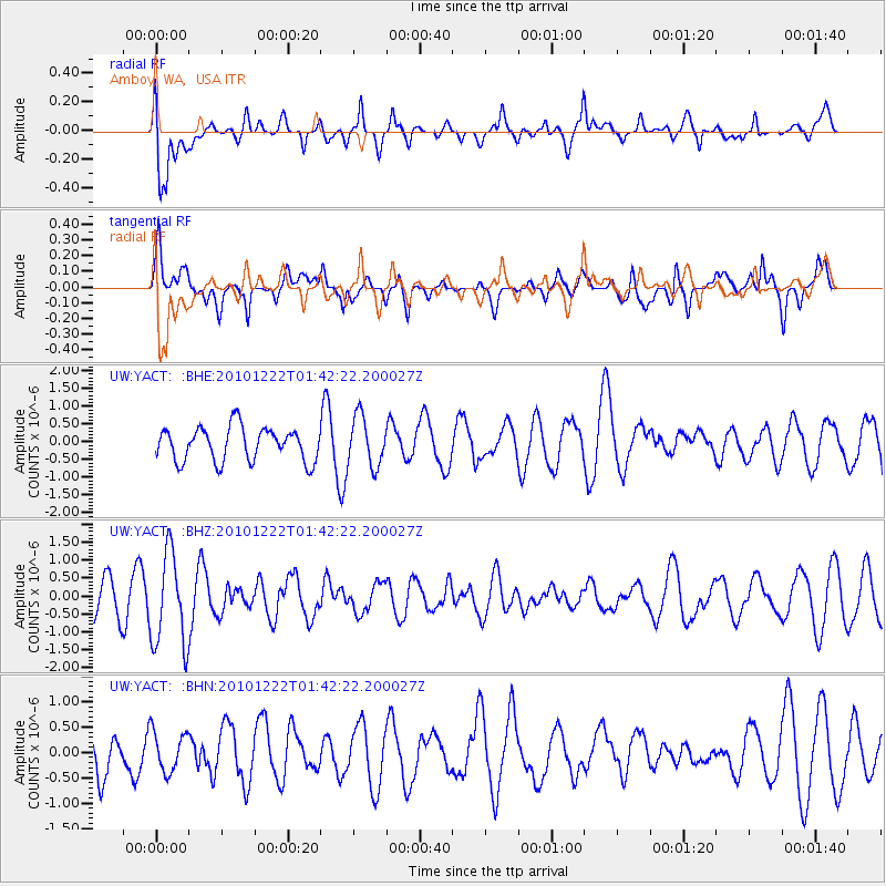
YACT Amboy, WA, USA - Earthquake Result Viewer
*The percent match for this event was below the threshold and hence no stack was calculated.
| Earthquake location: |
Bonin Islands, Japan Region |
| Earthquake latitude/longitude: |
26.7/143.5 |
| Earthquake time(UTC): |
2010/12/22 (356) 01:31:17 GMT |
| Earthquake Depth: |
10 km |
| Earthquake Magnitude: |
5.5 MB, 5.2 MS, 5.6 MW |
| Earthquake Catalog/Contributor: |
WHDF/NEIC |
|
| Network: |
UW Pacific Northwest Regional Seismic Network |
| Station: |
YACT Amboy, WA, USA |
| Lat/Lon: |
45.93 N/122.42 W |
| Elevation: |
211 m |
|
| Distance: |
74.0 deg |
| Az: |
46.405 deg |
| Baz: |
291.788 deg |
| Ray Param: |
$rayparam |
*The percent match for this event was below the threshold and hence was not used in the summary stack. |
|
| Radial Match: |
44.835266 % |
| Radial Bump: |
400 |
| Transverse Match: |
51.431175 % |
| Transverse Bump: |
400 |
| SOD ConfigId: |
346175 |
| Insert Time: |
2011-05-24 23:42:48.694 +0000 |
| GWidth: |
2.5 |
| Max Bumps: |
400 |
| Tol: |
0.001 |
|
Signal To Noise
| Channel | StoN | STA | LTA |
| UW:YACT: :BHZ:20101222T01:42:22.200027Z | 3.0569549 | 1.3037273E-6 | 4.264791E-7 |
| UW:YACT: :BHN:20101222T01:42:22.200027Z | 0.903582 | 3.963045E-7 | 4.3859274E-7 |
| UW:YACT: :BHE:20101222T01:42:22.200027Z | 1.4787297 | 6.970166E-7 | 4.7136174E-7 |
| Arrivals |
| Ps | |
| PpPs | |
| PsPs/PpSs | |


