You are here: Home > Network List > UW - Pacific Northwest Regional Seismic Network Stations List
> Station PASS Maple Falls, WA, USA > Earthquake Result Viewer
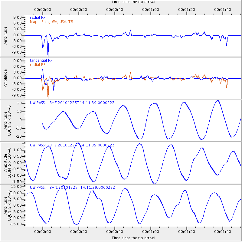
PASS Maple Falls, WA, USA - Earthquake Result Viewer
*The percent match for this event was below the threshold and hence no stack was calculated.
| Earthquake location: |
Vanuatu Islands |
| Earthquake latitude/longitude: |
-19.3/168.0 |
| Earthquake time(UTC): |
2010/12/25 (359) 13:59:02 GMT |
| Earthquake Depth: |
10 km |
| Earthquake Magnitude: |
5.5 MB |
| Earthquake Catalog/Contributor: |
WHDF/NEIC |
|
| Network: |
UW Pacific Northwest Regional Seismic Network |
| Station: |
PASS Maple Falls, WA, USA |
| Lat/Lon: |
49.00 N/122.09 W |
| Elevation: |
174 m |
|
| Distance: |
91.9 deg |
| Az: |
38.234 deg |
| Baz: |
242.561 deg |
| Ray Param: |
$rayparam |
*The percent match for this event was below the threshold and hence was not used in the summary stack. |
|
| Radial Match: |
91.46738 % |
| Radial Bump: |
400 |
| Transverse Match: |
96.72309 % |
| Transverse Bump: |
288 |
| SOD ConfigId: |
346175 |
| Insert Time: |
2011-05-25 00:53:55.157 +0000 |
| GWidth: |
2.5 |
| Max Bumps: |
400 |
| Tol: |
0.001 |
|
Signal To Noise
| Channel | StoN | STA | LTA |
| UW:PASS: :BHZ:20101225T14:11:39.000022Z | 1.4207455 | 1.1991748E-6 | 8.440461E-7 |
| UW:PASS: :BHN:20101225T14:11:39.000022Z | 2.011532 | 1.2677538E-5 | 6.3024286E-6 |
| UW:PASS: :BHE:20101225T14:11:39.000022Z | 1.2844789 | 8.94189E-6 | 6.961492E-6 |
| Arrivals |
| Ps | |
| PpPs | |
| PsPs/PpSs | |


