You are here: Home > Network List > TA - USArray Transportable Network (new EarthScope stations) Stations List
> Station R11A Troy Canyon, Currant, NV, USA > Earthquake Result Viewer
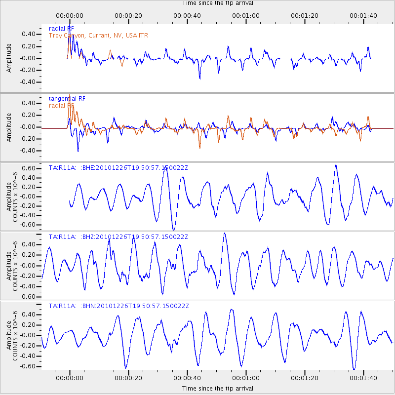
R11A Troy Canyon, Currant, NV, USA - Earthquake Result Viewer
*The percent match for this event was below the threshold and hence no stack was calculated.
| Earthquake location: |
Vanuatu Islands |
| Earthquake latitude/longitude: |
-19.6/168.3 |
| Earthquake time(UTC): |
2010/12/26 (360) 19:38:21 GMT |
| Earthquake Depth: |
10 km |
| Earthquake Magnitude: |
5.8 MB, 5.4 MS, 5.5 MW |
| Earthquake Catalog/Contributor: |
WHDF/NEIC |
|
| Network: |
TA USArray Transportable Network (new EarthScope stations) |
| Station: |
R11A Troy Canyon, Currant, NV, USA |
| Lat/Lon: |
38.35 N/115.59 W |
| Elevation: |
1756 m |
|
| Distance: |
91.7 deg |
| Az: |
49.795 deg |
| Baz: |
246.284 deg |
| Ray Param: |
$rayparam |
*The percent match for this event was below the threshold and hence was not used in the summary stack. |
|
| Radial Match: |
54.851624 % |
| Radial Bump: |
273 |
| Transverse Match: |
52.223022 % |
| Transverse Bump: |
332 |
| SOD ConfigId: |
346175 |
| Insert Time: |
2011-05-25 01:44:03.409 +0000 |
| GWidth: |
2.5 |
| Max Bumps: |
400 |
| Tol: |
0.001 |
|
Signal To Noise
| Channel | StoN | STA | LTA |
| TA:R11A: :BHZ:20101226T19:50:57.150022Z | 0.5165864 | 1.4723159E-7 | 2.850086E-7 |
| TA:R11A: :BHN:20101226T19:50:57.150022Z | 0.6583931 | 1.1836343E-7 | 1.7977622E-7 |
| TA:R11A: :BHE:20101226T19:50:57.150022Z | 2.7838266 | 4.2805326E-7 | 1.5376435E-7 |
| Arrivals |
| Ps | |
| PpPs | |
| PsPs/PpSs | |


