You are here: Home > Network List > AZ - ANZA Regional Network Stations List
> Station FRD AZ.FRD > Earthquake Result Viewer
FRD AZ.FRD - Earthquake Result Viewer

| Earthquake location: |
South Of Fiji Islands |
| Earthquake latitude/longitude: |
-22.1/-176.8 |
| Earthquake time(UTC): |
1997/10/14 (287) 09:53:18 GMT |
| Earthquake Depth: |
167 km |
| Earthquake Magnitude: |
6.7 MB, 7.7 UNKNOWN, 7.4 ME |
| Earthquake Catalog/Contributor: |
WHDF/NEIC |
|
| Network: |
AZ ANZA Regional Network |
| Station: |
FRD AZ.FRD |
| Lat/Lon: |
33.49 N/116.60 W |
| Elevation: |
1164 m |
|
| Distance: |
79.6 deg |
| Az: |
47.473 deg |
| Baz: |
234.873 deg |
| Ray Param: |
0.04842366 |
| Estimated Moho Depth: |
66.5 km |
| Estimated Crust Vp/Vs: |
1.64 |
| Assumed Crust Vp: |
6.264 km/s |
| Estimated Crust Vs: |
3.808 km/s |
| Estimated Crust Poisson's Ratio: |
0.21 |
|
| Radial Match: |
96.88694 % |
| Radial Bump: |
400 |
| Transverse Match: |
91.580315 % |
| Transverse Bump: |
400 |
| SOD ConfigId: |
6273 |
| Insert Time: |
2010-02-26 19:15:29.556 +0000 |
| GWidth: |
2.5 |
| Max Bumps: |
400 |
| Tol: |
0.001 |
|
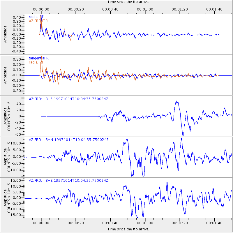
Signal To Noise
| Channel | StoN | STA | LTA |
| AZ:FRD: :BHN:19971014T10:04:35.750024Z | 1.8718792 | 4.3164732E-7 | 2.3059572E-7 |
| AZ:FRD: :BHE:19971014T10:04:35.750024Z | 2.1744564 | 4.1517384E-7 | 1.9093224E-7 |
| AZ:FRD: :BHZ:19971014T10:04:35.750024Z | 3.8104458 | 1.0106696E-6 | 2.6523657E-7 |
| Arrivals |
| Ps | 7.0 SECOND |
| PpPs | 27 SECOND |
| PsPs/PpSs | 34 SECOND |


