You are here: Home > Network List > TA - USArray Transportable Network (new EarthScope stations) Stations List
> Station J34A George, IA, USA > Earthquake Result Viewer
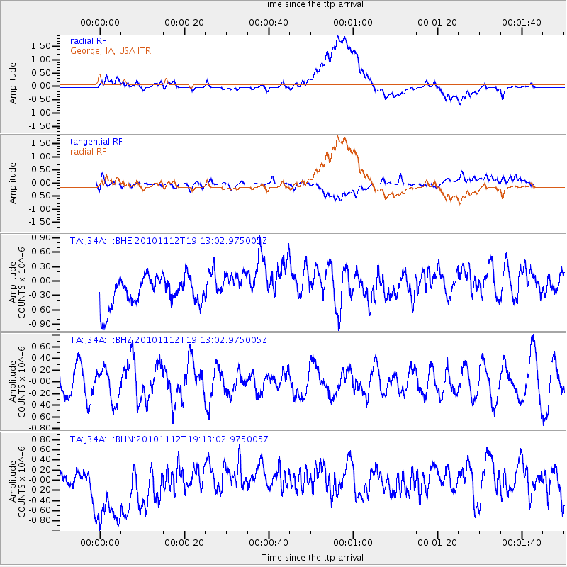
J34A George, IA, USA - Earthquake Result Viewer
*The percent match for this event was below the threshold and hence no stack was calculated.
| Earthquake location: |
Southeast Of Easter Island |
| Earthquake latitude/longitude: |
-36.0/-102.2 |
| Earthquake time(UTC): |
2010/11/12 (316) 19:01:29 GMT |
| Earthquake Depth: |
10 km |
| Earthquake Magnitude: |
5.8 MW, 5.3 MS, 5.4 MB, 5.8 MW |
| Earthquake Catalog/Contributor: |
WHDF/NEIC |
|
| Network: |
TA USArray Transportable Network (new EarthScope stations) |
| Station: |
J34A George, IA, USA |
| Lat/Lon: |
43.28 N/95.96 W |
| Elevation: |
432 m |
|
| Distance: |
79.1 deg |
| Az: |
4.646 deg |
| Baz: |
185.163 deg |
| Ray Param: |
$rayparam |
*The percent match for this event was below the threshold and hence was not used in the summary stack. |
|
| Radial Match: |
63.732 % |
| Radial Bump: |
400 |
| Transverse Match: |
55.208065 % |
| Transverse Bump: |
400 |
| SOD ConfigId: |
346175 |
| Insert Time: |
2011-05-25 03:12:56.019 +0000 |
| GWidth: |
2.5 |
| Max Bumps: |
400 |
| Tol: |
0.001 |
|
Signal To Noise
| Channel | StoN | STA | LTA |
| TA:J34A: :BHZ:20101112T19:13:02.975005Z | 1.4819218 | 2.807989E-7 | 1.8948295E-7 |
| TA:J34A: :BHN:20101112T19:13:02.975005Z | 1.5248463 | 1.2422247E-6 | 8.146556E-7 |
| TA:J34A: :BHE:20101112T19:13:02.975005Z | 1.0327094 | 3.050965E-7 | 2.9543307E-7 |
| Arrivals |
| Ps | |
| PpPs | |
| PsPs/PpSs | |


