You are here: Home > Network List > US - United States National Seismic Network Stations List
> Station EGMT Eagleton, Montana, USA > Earthquake Result Viewer
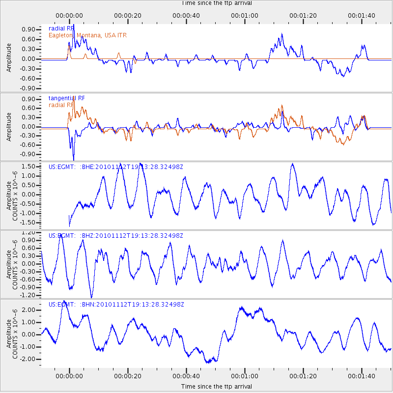
EGMT Eagleton, Montana, USA - Earthquake Result Viewer
*The percent match for this event was below the threshold and hence no stack was calculated.
| Earthquake location: |
Southeast Of Easter Island |
| Earthquake latitude/longitude: |
-36.0/-102.2 |
| Earthquake time(UTC): |
2010/11/12 (316) 19:01:29 GMT |
| Earthquake Depth: |
10 km |
| Earthquake Magnitude: |
5.8 MW, 5.3 MS, 5.4 MB, 5.8 MW |
| Earthquake Catalog/Contributor: |
WHDF/NEIC |
|
| Network: |
US United States National Seismic Network |
| Station: |
EGMT Eagleton, Montana, USA |
| Lat/Lon: |
48.02 N/109.75 W |
| Elevation: |
1055 m |
|
| Distance: |
83.9 deg |
| Az: |
354.914 deg |
| Baz: |
173.85 deg |
| Ray Param: |
$rayparam |
*The percent match for this event was below the threshold and hence was not used in the summary stack. |
|
| Radial Match: |
22.407408 % |
| Radial Bump: |
400 |
| Transverse Match: |
66.822014 % |
| Transverse Bump: |
400 |
| SOD ConfigId: |
346175 |
| Insert Time: |
2011-05-25 03:16:58.840 +0000 |
| GWidth: |
2.5 |
| Max Bumps: |
400 |
| Tol: |
0.001 |
|
Signal To Noise
| Channel | StoN | STA | LTA |
| US:EGMT: :BHZ:20101112T19:13:28.32498Z | 1.7171147 | 6.853762E-7 | 3.991441E-7 |
| US:EGMT: :BHN:20101112T19:13:28.32498Z | 2.183459 | 2.023603E-6 | 9.2678766E-7 |
| US:EGMT: :BHE:20101112T19:13:28.32498Z | 0.29564285 | 2.3846093E-7 | 8.0658447E-7 |
| Arrivals |
| Ps | |
| PpPs | |
| PsPs/PpSs | |


