You are here: Home > Network List > TA - USArray Transportable Network (new EarthScope stations) Stations List
> Station R31A Burdett, KS, USA > Earthquake Result Viewer
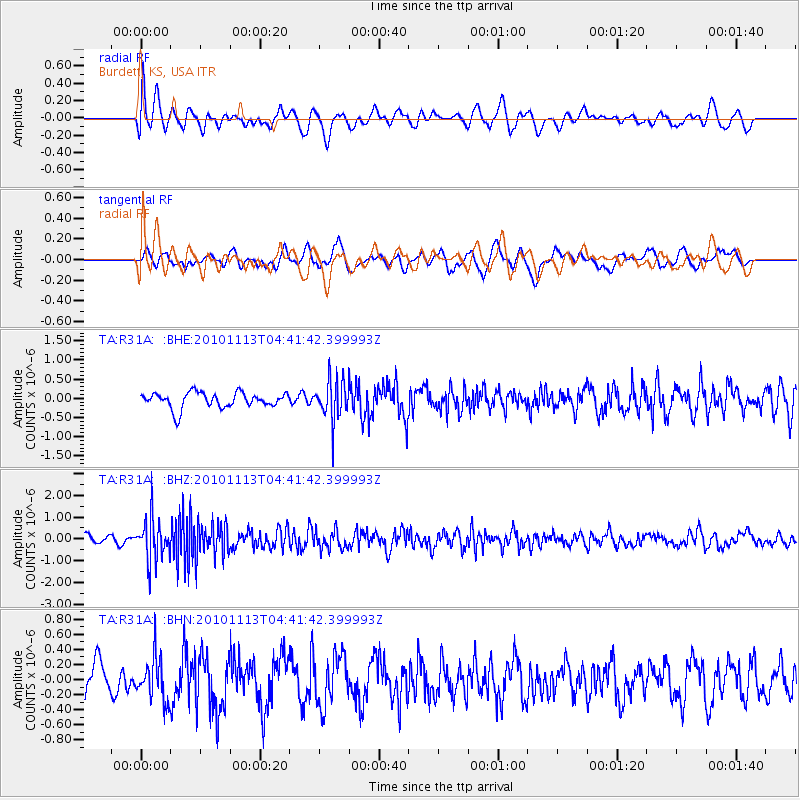
R31A Burdett, KS, USA - Earthquake Result Viewer
*The percent match for this event was below the threshold and hence no stack was calculated.
| Earthquake location: |
Mona Passage |
| Earthquake latitude/longitude: |
17.9/-68.5 |
| Earthquake time(UTC): |
2010/11/13 (317) 04:35:39 GMT |
| Earthquake Depth: |
95 km |
| Earthquake Magnitude: |
5.6 MB, 5.4 MW, 5.6 MW |
| Earthquake Catalog/Contributor: |
WHDF/NEIC |
|
| Network: |
TA USArray Transportable Network (new EarthScope stations) |
| Station: |
R31A Burdett, KS, USA |
| Lat/Lon: |
38.29 N/99.53 W |
| Elevation: |
667 m |
|
| Distance: |
33.8 deg |
| Az: |
313.305 deg |
| Baz: |
118.276 deg |
| Ray Param: |
$rayparam |
*The percent match for this event was below the threshold and hence was not used in the summary stack. |
|
| Radial Match: |
67.02255 % |
| Radial Bump: |
400 |
| Transverse Match: |
43.584164 % |
| Transverse Bump: |
400 |
| SOD ConfigId: |
346175 |
| Insert Time: |
2011-05-25 04:02:35.282 +0000 |
| GWidth: |
2.5 |
| Max Bumps: |
400 |
| Tol: |
0.001 |
|
Signal To Noise
| Channel | StoN | STA | LTA |
| TA:R31A: :BHZ:20101113T04:41:42.399993Z | 4.576098 | 9.4878476E-7 | 2.0733488E-7 |
| TA:R31A: :BHN:20101113T04:41:42.399993Z | 1.1244152 | 2.844676E-7 | 2.529916E-7 |
| TA:R31A: :BHE:20101113T04:41:42.399993Z | 2.549505 | 5.1616934E-7 | 2.0245864E-7 |
| Arrivals |
| Ps | |
| PpPs | |
| PsPs/PpSs | |


