You are here: Home > Network List > TA - USArray Transportable Network (new EarthScope stations) Stations List
> Station U35A Pawnee, OK, USA > Earthquake Result Viewer
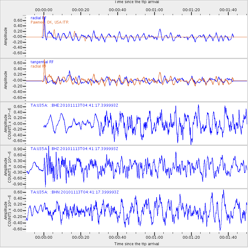
U35A Pawnee, OK, USA - Earthquake Result Viewer
*The percent match for this event was below the threshold and hence no stack was calculated.
| Earthquake location: |
Mona Passage |
| Earthquake latitude/longitude: |
17.9/-68.5 |
| Earthquake time(UTC): |
2010/11/13 (317) 04:35:39 GMT |
| Earthquake Depth: |
95 km |
| Earthquake Magnitude: |
5.6 MB, 5.4 MW, 5.6 MW |
| Earthquake Catalog/Contributor: |
WHDF/NEIC |
|
| Network: |
TA USArray Transportable Network (new EarthScope stations) |
| Station: |
U35A Pawnee, OK, USA |
| Lat/Lon: |
36.37 N/96.73 W |
| Elevation: |
303 m |
|
| Distance: |
31.0 deg |
| Az: |
312.163 deg |
| Baz: |
118.999 deg |
| Ray Param: |
$rayparam |
*The percent match for this event was below the threshold and hence was not used in the summary stack. |
|
| Radial Match: |
53.558002 % |
| Radial Bump: |
400 |
| Transverse Match: |
52.069584 % |
| Transverse Bump: |
400 |
| SOD ConfigId: |
346175 |
| Insert Time: |
2011-05-25 04:33:03.772 +0000 |
| GWidth: |
2.5 |
| Max Bumps: |
400 |
| Tol: |
0.001 |
|
Signal To Noise
| Channel | StoN | STA | LTA |
| TA:U35A: :BHZ:20101113T04:41:17.399993Z | 1.4991947 | 4.0347413E-7 | 2.6912724E-7 |
| TA:U35A: :BHN:20101113T04:41:17.399993Z | 0.72283554 | 1.353613E-7 | 1.8726433E-7 |
| TA:U35A: :BHE:20101113T04:41:17.399993Z | 1.4690206 | 2.2677348E-7 | 1.5437053E-7 |
| Arrivals |
| Ps | |
| PpPs | |
| PsPs/PpSs | |


