You are here: Home > Network List > US - United States National Seismic Network Stations List
> Station WMOK Wichita Mountains, Oklahoma, USA > Earthquake Result Viewer
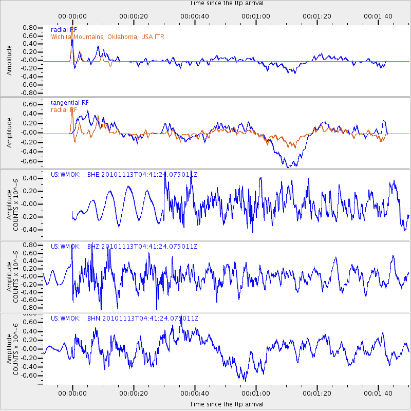
WMOK Wichita Mountains, Oklahoma, USA - Earthquake Result Viewer
*The percent match for this event was below the threshold and hence no stack was calculated.
| Earthquake location: |
Mona Passage |
| Earthquake latitude/longitude: |
17.9/-68.5 |
| Earthquake time(UTC): |
2010/11/13 (317) 04:35:39 GMT |
| Earthquake Depth: |
95 km |
| Earthquake Magnitude: |
5.6 MB, 5.4 MW, 5.6 MW |
| Earthquake Catalog/Contributor: |
WHDF/NEIC |
|
| Network: |
US United States National Seismic Network |
| Station: |
WMOK Wichita Mountains, Oklahoma, USA |
| Lat/Lon: |
34.74 N/98.78 W |
| Elevation: |
486 m |
|
| Distance: |
31.7 deg |
| Az: |
307.923 deg |
| Baz: |
114.191 deg |
| Ray Param: |
$rayparam |
*The percent match for this event was below the threshold and hence was not used in the summary stack. |
|
| Radial Match: |
51.181435 % |
| Radial Bump: |
400 |
| Transverse Match: |
40.218353 % |
| Transverse Bump: |
400 |
| SOD ConfigId: |
346175 |
| Insert Time: |
2011-05-25 04:43:23.801 +0000 |
| GWidth: |
2.5 |
| Max Bumps: |
400 |
| Tol: |
0.001 |
|
Signal To Noise
| Channel | StoN | STA | LTA |
| US:WMOK: :BHZ:20101113T04:41:24.075011Z | 1.9818391 | 3.1332448E-7 | 1.5809783E-7 |
| US:WMOK: :BHN:20101113T04:41:24.075011Z | 0.7731045 | 3.0289627E-7 | 3.9179213E-7 |
| US:WMOK: :BHE:20101113T04:41:24.075011Z | 1.1726247 | 1.9162441E-7 | 1.6341494E-7 |
| Arrivals |
| Ps | |
| PpPs | |
| PsPs/PpSs | |


