You are here: Home > Network List > US - United States National Seismic Network Stations List
> Station CBKS Cedar Bluff, Kansas, USA > Earthquake Result Viewer
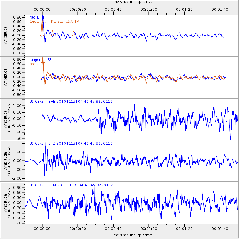
CBKS Cedar Bluff, Kansas, USA - Earthquake Result Viewer
*The percent match for this event was below the threshold and hence no stack was calculated.
| Earthquake location: |
Mona Passage |
| Earthquake latitude/longitude: |
17.9/-68.5 |
| Earthquake time(UTC): |
2010/11/13 (317) 04:35:39 GMT |
| Earthquake Depth: |
95 km |
| Earthquake Magnitude: |
5.6 MB, 5.4 MW, 5.6 MW |
| Earthquake Catalog/Contributor: |
WHDF/NEIC |
|
| Network: |
US United States National Seismic Network |
| Station: |
CBKS Cedar Bluff, Kansas, USA |
| Lat/Lon: |
38.81 N/99.74 W |
| Elevation: |
677 m |
|
| Distance: |
34.2 deg |
| Az: |
313.989 deg |
| Baz: |
118.711 deg |
| Ray Param: |
$rayparam |
*The percent match for this event was below the threshold and hence was not used in the summary stack. |
|
| Radial Match: |
60.58062 % |
| Radial Bump: |
400 |
| Transverse Match: |
44.78201 % |
| Transverse Bump: |
400 |
| SOD ConfigId: |
346175 |
| Insert Time: |
2011-05-25 04:44:32.512 +0000 |
| GWidth: |
2.5 |
| Max Bumps: |
400 |
| Tol: |
0.001 |
|
Signal To Noise
| Channel | StoN | STA | LTA |
| US:CBKS: :BHZ:20101113T04:41:45.825011Z | 5.3924117 | 7.061906E-7 | 1.3096006E-7 |
| US:CBKS: :BHN:20101113T04:41:45.825011Z | 1.6498139 | 3.0741793E-7 | 1.8633492E-7 |
| US:CBKS: :BHE:20101113T04:41:45.825011Z | 2.539189 | 3.9419325E-7 | 1.5524377E-7 |
| Arrivals |
| Ps | |
| PpPs | |
| PsPs/PpSs | |


