You are here: Home > Network List > TA - USArray Transportable Network (new EarthScope stations) Stations List
> Station J35A Milford, IA, USA > Earthquake Result Viewer
J35A Milford, IA, USA - Earthquake Result Viewer

| Earthquake location: |
Santiago Del Estero Prov., Arg. |
| Earthquake latitude/longitude: |
-26.8/-63.1 |
| Earthquake time(UTC): |
2011/01/01 (001) 09:56:58 GMT |
| Earthquake Depth: |
577 km |
| Earthquake Magnitude: |
6.8 MB, 7.0 MW, 7.0 MW |
| Earthquake Catalog/Contributor: |
WHDF/NEIC |
|
| Network: |
TA USArray Transportable Network (new EarthScope stations) |
| Station: |
J35A Milford, IA, USA |
| Lat/Lon: |
43.37 N/95.21 W |
| Elevation: |
457 m |
|
| Distance: |
75.8 deg |
| Az: |
336.456 deg |
| Baz: |
150.689 deg |
| Ray Param: |
0.049578592 |
| Estimated Moho Depth: |
43.75 km |
| Estimated Crust Vp/Vs: |
2.10 |
| Assumed Crust Vp: |
6.53 km/s |
| Estimated Crust Vs: |
3.113 km/s |
| Estimated Crust Poisson's Ratio: |
0.35 |
|
| Radial Match: |
86.6531 % |
| Radial Bump: |
400 |
| Transverse Match: |
82.19387 % |
| Transverse Bump: |
400 |
| SOD ConfigId: |
346946 |
| Insert Time: |
2011-07-04 08:04:19.773 +0000 |
| GWidth: |
2.5 |
| Max Bumps: |
400 |
| Tol: |
0.001 |
|
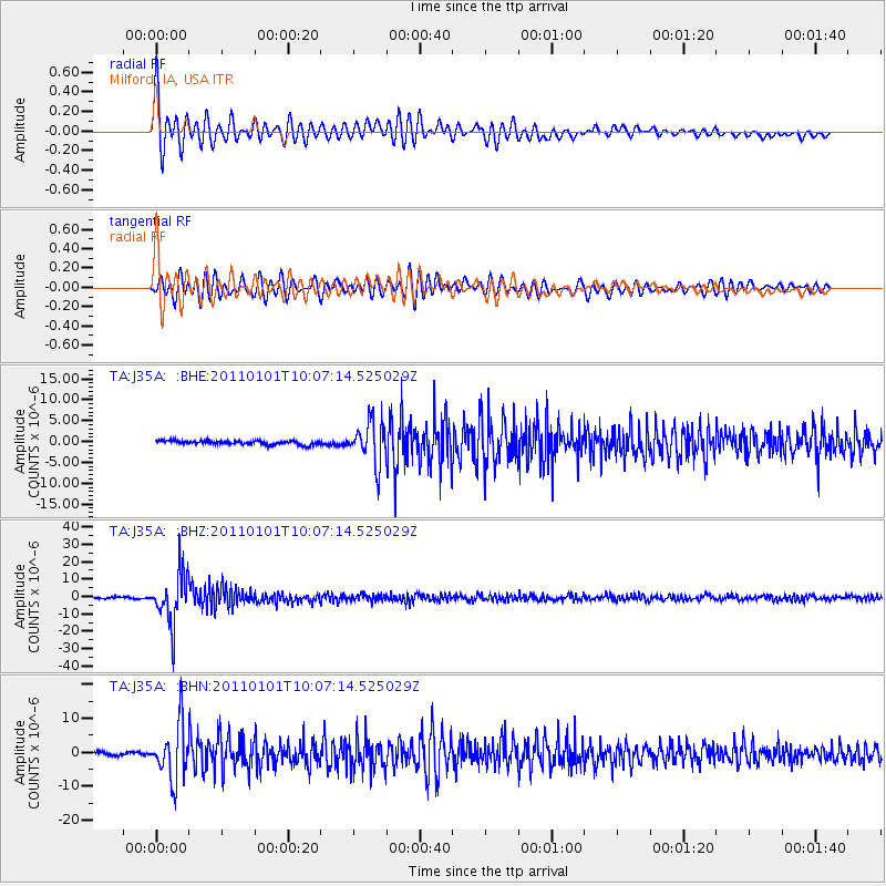
Signal To Noise
| Channel | StoN | STA | LTA |
| TA:J35A: :BHZ:20110101T10:07:14.525029Z | 41.523712 | 1.4324571E-5 | 3.4497327E-7 |
| TA:J35A: :BHN:20110101T10:07:14.525029Z | 19.802082 | 7.965548E-6 | 4.0225814E-7 |
| TA:J35A: :BHE:20110101T10:07:14.525029Z | 10.953268 | 5.0098733E-6 | 4.5738616E-7 |
| Arrivals |
| Ps | 7.5 SECOND |
| PpPs | 20 SECOND |
| PsPs/PpSs | 28 SECOND |


