You are here: Home > Network List > G - GEOSCOPE Stations List
> Station TAM Tamanrasset, Algeria > Earthquake Result Viewer
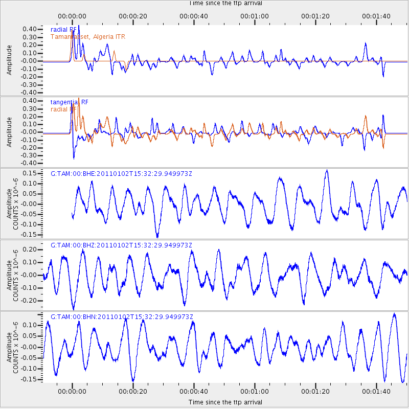
TAM Tamanrasset, Algeria - Earthquake Result Viewer
*The percent match for this event was below the threshold and hence no stack was calculated.
| Earthquake location: |
Southern Sumatra, Indonesia |
| Earthquake latitude/longitude: |
-4.5/101.4 |
| Earthquake time(UTC): |
2011/01/02 (002) 15:19:31 GMT |
| Earthquake Depth: |
22 km |
| Earthquake Magnitude: |
5.7 MB, 5.6 MS, 5.8 MW, 5.7 MW |
| Earthquake Catalog/Contributor: |
WHDF/NEIC |
|
| Network: |
G GEOSCOPE |
| Station: |
TAM Tamanrasset, Algeria |
| Lat/Lon: |
22.79 N/5.53 E |
| Elevation: |
1377 m |
|
| Distance: |
97.1 deg |
| Az: |
292.311 deg |
| Baz: |
91.835 deg |
| Ray Param: |
$rayparam |
*The percent match for this event was below the threshold and hence was not used in the summary stack. |
|
| Radial Match: |
72.80664 % |
| Radial Bump: |
400 |
| Transverse Match: |
67.42808 % |
| Transverse Bump: |
400 |
| SOD ConfigId: |
346946 |
| Insert Time: |
2011-07-04 08:42:26.903 +0000 |
| GWidth: |
2.5 |
| Max Bumps: |
400 |
| Tol: |
0.001 |
|
Signal To Noise
| Channel | StoN | STA | LTA |
| G:TAM:00:BHZ:20110102T15:32:29.949973Z | 2.7972581 | 1.5306676E-7 | 5.4720285E-8 |
| G:TAM:00:BHN:20110102T15:32:29.949973Z | 1.196503 | 6.8277345E-8 | 5.706408E-8 |
| G:TAM:00:BHE:20110102T15:32:29.949973Z | 0.9767908 | 4.894944E-8 | 5.011251E-8 |
| Arrivals |
| Ps | |
| PpPs | |
| PsPs/PpSs | |


