You are here: Home > Network List > IC - New China Digital Seismograph Network Stations List
> Station ENH Enshi, Hubei Province, China > Earthquake Result Viewer
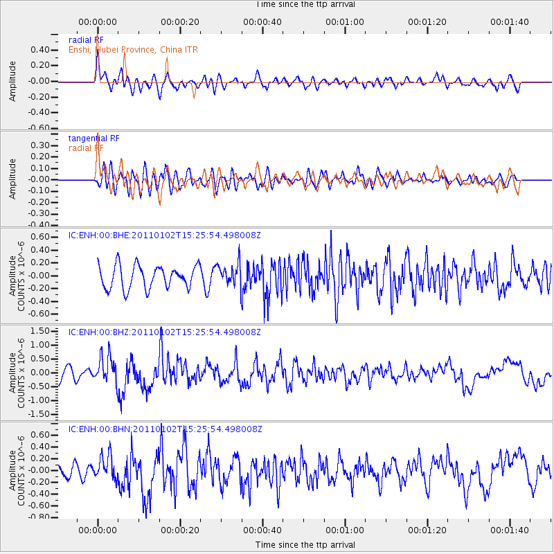
ENH Enshi, Hubei Province, China - Earthquake Result Viewer
*The percent match for this event was below the threshold and hence no stack was calculated.
| Earthquake location: |
Southern Sumatra, Indonesia |
| Earthquake latitude/longitude: |
-4.5/101.4 |
| Earthquake time(UTC): |
2011/01/02 (002) 15:19:31 GMT |
| Earthquake Depth: |
22 km |
| Earthquake Magnitude: |
5.7 MB, 5.6 MS, 5.8 MW, 5.7 MW |
| Earthquake Catalog/Contributor: |
WHDF/NEIC |
|
| Network: |
IC New China Digital Seismograph Network |
| Station: |
ENH Enshi, Hubei Province, China |
| Lat/Lon: |
30.28 N/109.49 E |
| Elevation: |
500 m |
|
| Distance: |
35.4 deg |
| Az: |
12.099 deg |
| Baz: |
193.979 deg |
| Ray Param: |
$rayparam |
*The percent match for this event was below the threshold and hence was not used in the summary stack. |
|
| Radial Match: |
71.18539 % |
| Radial Bump: |
400 |
| Transverse Match: |
53.057896 % |
| Transverse Bump: |
400 |
| SOD ConfigId: |
346946 |
| Insert Time: |
2011-07-04 08:42:57.393 +0000 |
| GWidth: |
2.5 |
| Max Bumps: |
400 |
| Tol: |
0.001 |
|
Signal To Noise
| Channel | StoN | STA | LTA |
| IC:ENH:00:BHZ:20110102T15:25:54.498008Z | 2.5489182 | 4.988065E-7 | 1.956934E-7 |
| IC:ENH:00:BHN:20110102T15:25:54.498008Z | 1.619088 | 2.1221594E-7 | 1.3107127E-7 |
| IC:ENH:00:BHE:20110102T15:25:54.498008Z | 0.9670475 | 1.72302E-7 | 1.7817325E-7 |
| Arrivals |
| Ps | |
| PpPs | |
| PsPs/PpSs | |


