You are here: Home > Network List > TA - USArray Transportable Network (new EarthScope stations) Stations List
> Station J04D Umpqua National Forest, Toketee, OR, USA > Earthquake Result Viewer
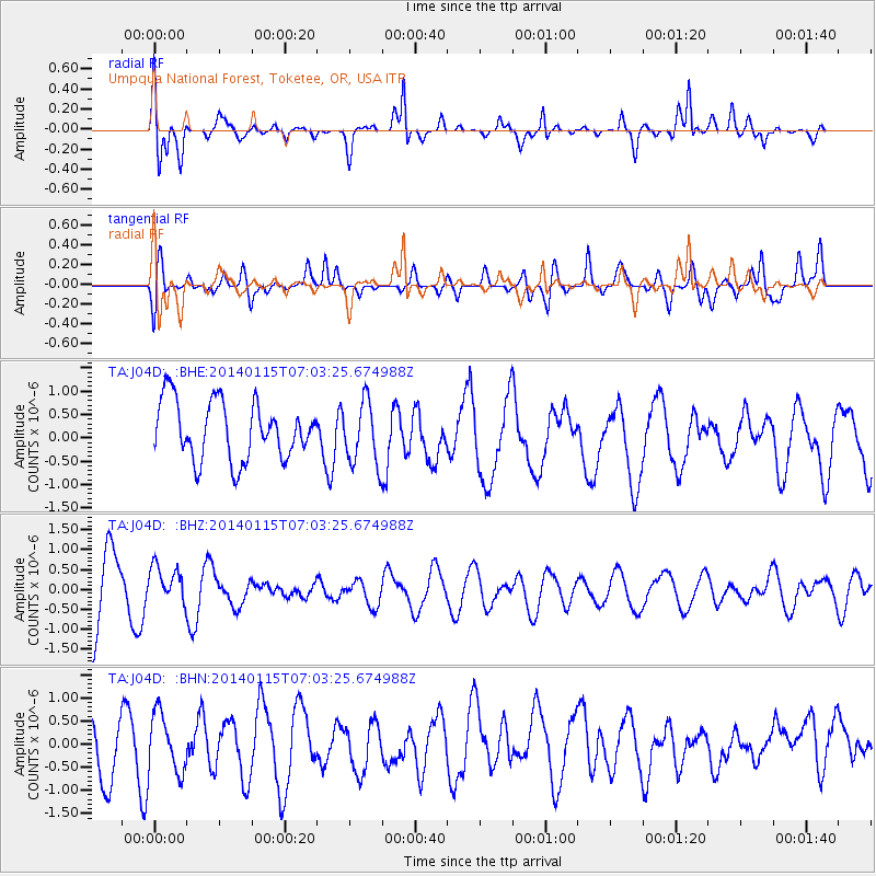
J04D Umpqua National Forest, Toketee, OR, USA - Earthquake Result Viewer
*The percent match for this event was below the threshold and hence no stack was calculated.
| Earthquake location: |
Sea Of Okhotsk |
| Earthquake latitude/longitude: |
51.5/151.0 |
| Earthquake time(UTC): |
2014/01/15 (015) 06:55:09 GMT |
| Earthquake Depth: |
551 km |
| Earthquake Magnitude: |
4.6 mb |
| Earthquake Catalog/Contributor: |
ISC/ISC |
|
| Network: |
TA USArray Transportable Network (new EarthScope stations) |
| Station: |
J04D Umpqua National Forest, Toketee, OR, USA |
| Lat/Lon: |
43.24 N/122.11 W |
| Elevation: |
1948 m |
|
| Distance: |
56.1 deg |
| Az: |
61.518 deg |
| Baz: |
311.276 deg |
| Ray Param: |
$rayparam |
*The percent match for this event was below the threshold and hence was not used in the summary stack. |
|
| Radial Match: |
62.021255 % |
| Radial Bump: |
400 |
| Transverse Match: |
43.87207 % |
| Transverse Bump: |
400 |
| SOD ConfigId: |
3390531 |
| Insert Time: |
2019-04-10 00:08:17.364 +0000 |
| GWidth: |
2.5 |
| Max Bumps: |
400 |
| Tol: |
0.001 |
|
Signal To Noise
| Channel | StoN | STA | LTA |
| TA:J04D: :BHZ:20140115T07:03:25.674988Z | 0.44598913 | 4.5160044E-7 | 1.0125816E-6 |
| TA:J04D: :BHN:20140115T07:03:25.674988Z | 1.1282768 | 6.275715E-7 | 5.562212E-7 |
| TA:J04D: :BHE:20140115T07:03:25.674988Z | 1.1033483 | 6.848632E-7 | 6.2071354E-7 |
| Arrivals |
| Ps | |
| PpPs | |
| PsPs/PpSs | |


