You are here: Home > Network List > AZ - ANZA Regional Network Stations List
> Station FRD AZ.FRD > Earthquake Result Viewer
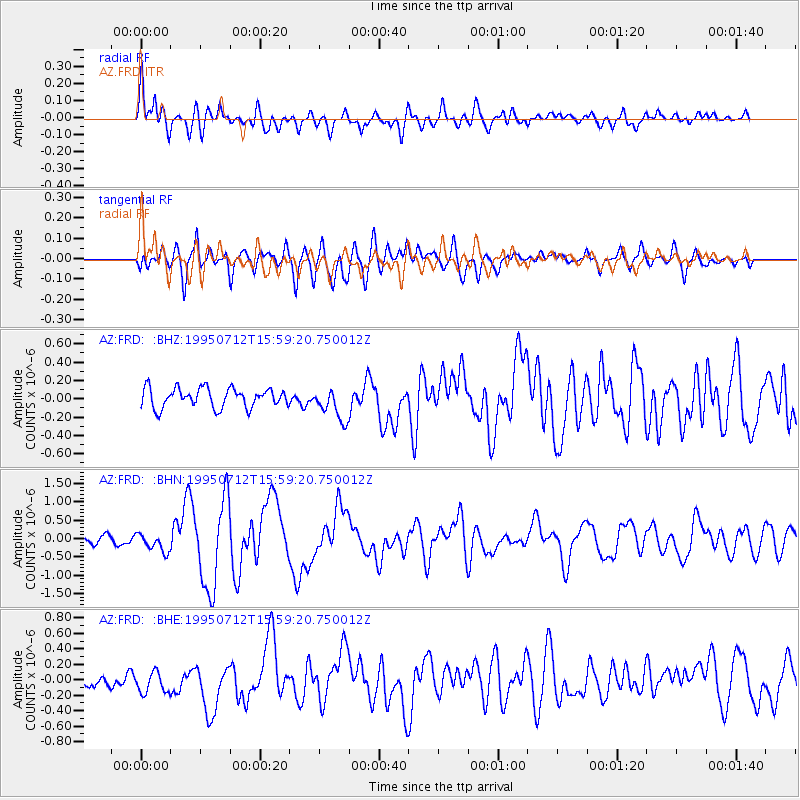
FRD AZ.FRD - Earthquake Result Viewer
*The percent match for this event was below the threshold and hence no stack was calculated.
| Earthquake location: |
Southeast Of Loyalty Islands |
| Earthquake latitude/longitude: |
-23.2/170.8 |
| Earthquake time(UTC): |
1995/07/12 (193) 15:46:59 GMT |
| Earthquake Depth: |
33 km |
| Earthquake Magnitude: |
5.9 MB, 6.4 MS, 6.5 UNKNOWN, 6.4 MW |
| Earthquake Catalog/Contributor: |
WHDF/NEIC |
|
| Network: |
AZ ANZA Regional Network |
| Station: |
FRD AZ.FRD |
| Lat/Lon: |
33.49 N/116.60 W |
| Elevation: |
1164 m |
|
| Distance: |
89.2 deg |
| Az: |
52.88 deg |
| Baz: |
241.368 deg |
| Ray Param: |
$rayparam |
*The percent match for this event was below the threshold and hence was not used in the summary stack. |
|
| Radial Match: |
77.886055 % |
| Radial Bump: |
400 |
| Transverse Match: |
70.77111 % |
| Transverse Bump: |
400 |
| SOD ConfigId: |
4480 |
| Insert Time: |
2010-02-26 19:18:49.760 +0000 |
| GWidth: |
2.5 |
| Max Bumps: |
400 |
| Tol: |
0.001 |
|
Signal To Noise
| Channel | StoN | STA | LTA |
| AZ:FRD: :BHN:19950712T15:59:20.750012Z | 2.1408892 | 2.4968327E-7 | 1.1662597E-7 |
| AZ:FRD: :BHE:19950712T15:59:20.750012Z | 1.2844986 | 1.507685E-7 | 1.1737537E-7 |
| AZ:FRD: :BHZ:19950712T15:59:20.750012Z | 1.6997623 | 1.7826864E-7 | 1.04878566E-7 |
| Arrivals |
| Ps | |
| PpPs | |
| PsPs/PpSs | |


