SMER AZ.SMER - Earthquake Result Viewer
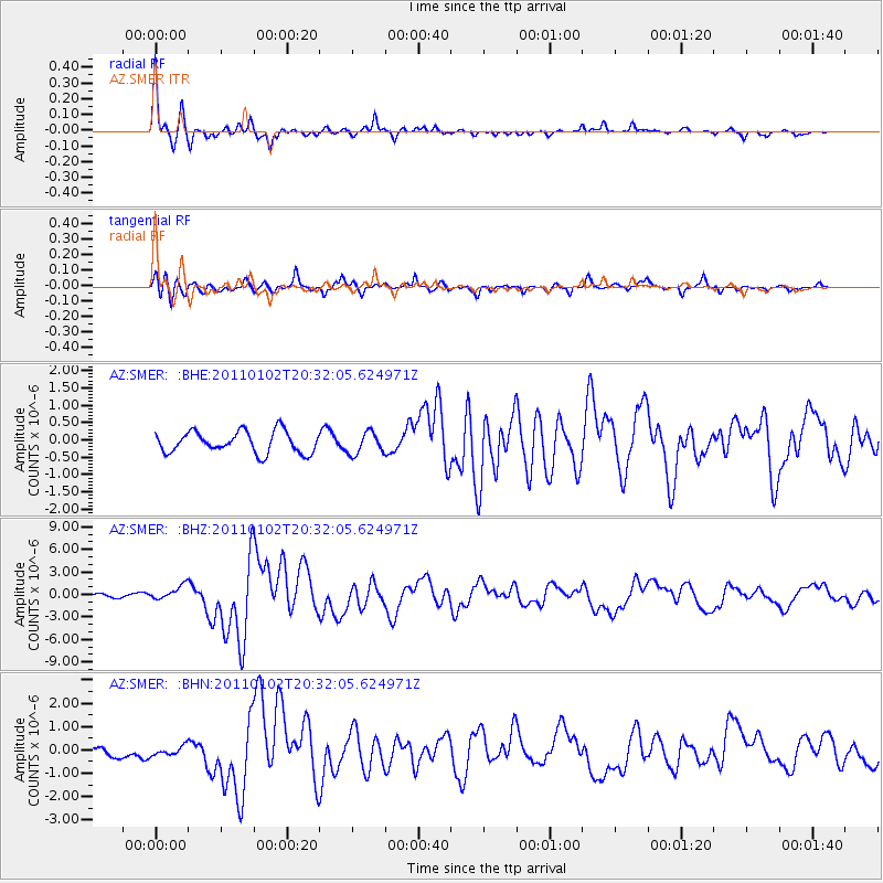
Earthquake location: Near Coast Of Central Chile
Earthquake latitude/longitude: -38.4/-73.3
Earthquake time(UTC): 2011/01/02 (002) 20:20:17 GMT
Earthquake Depth: 24 km
Earthquake Magnitude: 6.6 MB, 7.1 MS, 7.1 MW, 7.0 MW
Earthquake Catalog/Contributor: WHDF/NEIC
Network: AZ ANZA Regional Network
Station: SMER AZ.SMER
Lat/Lon: 33.46 N/117.17 W
Elevation: 355 m
Distance: 82.2 deg
Az: 324.237 deg
Baz: 146.658 deg
Ray Param: 0.046994574
Estimated Moho Depth: 34.25 km
Estimated Crust Vp/Vs: 1.72
Assumed Crust Vp: 6.264 km/s
Estimated Crust Vs: 3.642 km/s
Estimated Crust Poisson's Ratio: 0.24
Radial Match: 91.688995 %
Radial Bump: 224
Transverse Match: 75.65303 %
Transverse Bump: 400
SOD ConfigId: 346946
Insert Time: 2011-07-04 08:54:16.083 +0000
GWidth: 2.5
Max Bumps: 400
Tol: 0.001

Signal To Noise

ChannelStoNSTALTA
AZ:SMER: :BHZ:20110102T20:32:05.624971Z4.852819.397897E-71.9365886E-7
AZ:SMER: :BHN:20110102T20:32:05.624971Z0.77467732.0163455E-72.6028198E-7
AZ:SMER: :BHE:20110102T20:32:05.624971Z1.00725823.1159377E-73.0934848E-7
Arrivals
Ps4.0 SECOND
PpPs14 SECOND
PsPs/PpSs19 SECOND