You are here: Home > Network List > UW - Pacific Northwest Regional Seismic Network Stations List
> Station HOOD Mt Hood Meadows, OR CREST BB SMO > Earthquake Result Viewer
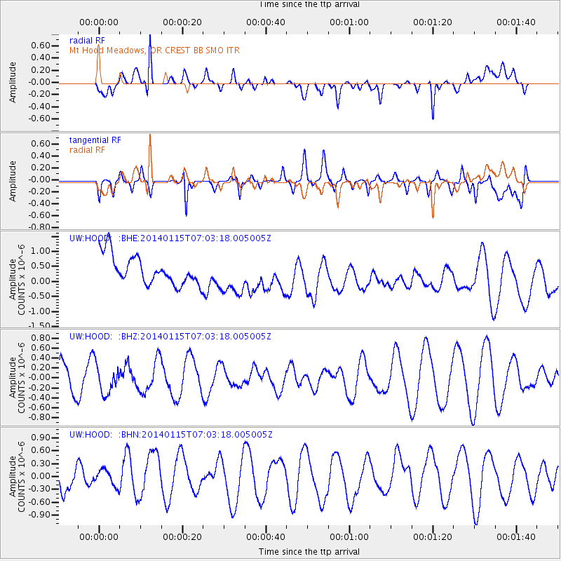
HOOD Mt Hood Meadows, OR CREST BB SMO - Earthquake Result Viewer
*The percent match for this event was below the threshold and hence no stack was calculated.
| Earthquake location: |
Sea Of Okhotsk |
| Earthquake latitude/longitude: |
51.5/151.0 |
| Earthquake time(UTC): |
2014/01/15 (015) 06:55:09 GMT |
| Earthquake Depth: |
551 km |
| Earthquake Magnitude: |
4.6 mb |
| Earthquake Catalog/Contributor: |
ISC/ISC |
|
| Network: |
UW Pacific Northwest Regional Seismic Network |
| Station: |
HOOD Mt Hood Meadows, OR CREST BB SMO |
| Lat/Lon: |
45.32 N/121.65 W |
| Elevation: |
1520 m |
|
| Distance: |
55.0 deg |
| Az: |
59.35 deg |
| Baz: |
310.367 deg |
| Ray Param: |
$rayparam |
*The percent match for this event was below the threshold and hence was not used in the summary stack. |
|
| Radial Match: |
43.137928 % |
| Radial Bump: |
400 |
| Transverse Match: |
66.53721 % |
| Transverse Bump: |
400 |
| SOD ConfigId: |
3390531 |
| Insert Time: |
2019-04-10 00:09:45.401 +0000 |
| GWidth: |
2.5 |
| Max Bumps: |
400 |
| Tol: |
0.001 |
|
Signal To Noise
| Channel | StoN | STA | LTA |
| UW:HOOD: :BHZ:20140115T07:03:18.005005Z | 1.1551169 | 2.5967762E-7 | 2.2480633E-7 |
| UW:HOOD: :BHN:20140115T07:03:18.005005Z | 0.7013992 | 2.2924274E-7 | 3.2683633E-7 |
| UW:HOOD: :BHE:20140115T07:03:18.005005Z | 1.3847431 | 6.5853396E-7 | 4.7556398E-7 |
| Arrivals |
| Ps | |
| PpPs | |
| PsPs/PpSs | |


