EMMW Machias, ME - Earthquake Result Viewer
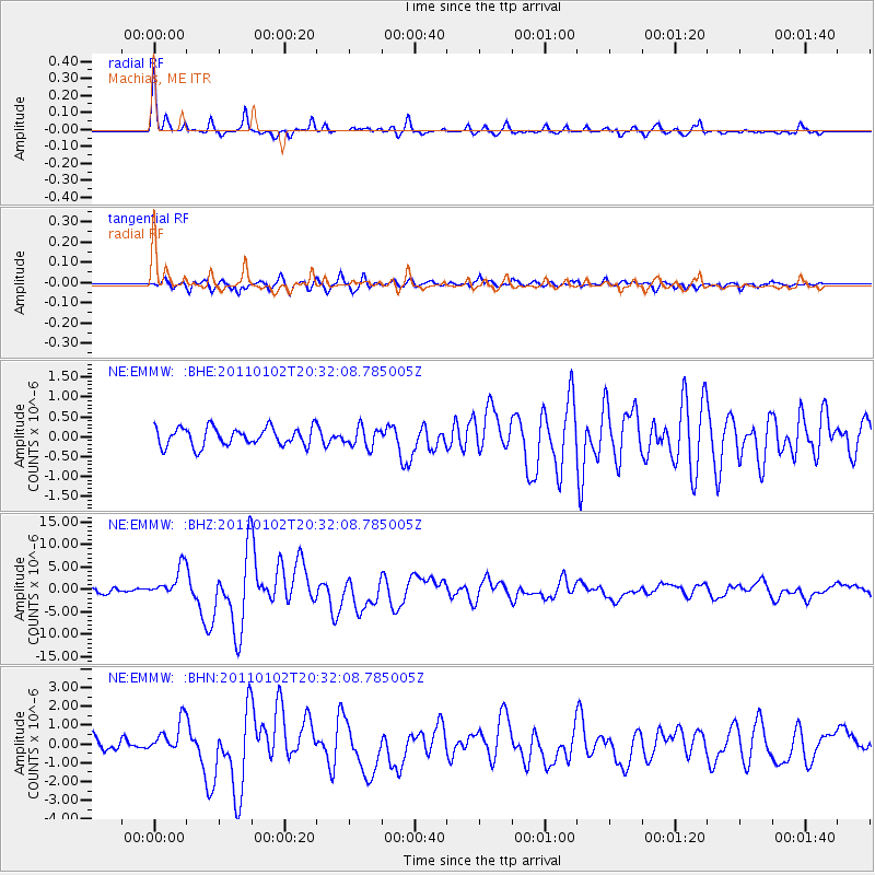
Earthquake location: Near Coast Of Central Chile
Earthquake latitude/longitude: -38.4/-73.3
Earthquake time(UTC): 2011/01/02 (002) 20:20:17 GMT
Earthquake Depth: 24 km
Earthquake Magnitude: 6.6 MB, 7.1 MS, 7.1 MW, 7.0 MW
Earthquake Catalog/Contributor: WHDF/NEIC
Network: NE New England Seismic Network
Station: EMMW Machias, ME
Lat/Lon: 44.71 N/67.46 W
Elevation: 34 m
Distance: 82.9 deg
Az: 4.213 deg
Baz: 184.647 deg
Ray Param: 0.0465718
Estimated Moho Depth: 31.5 km
Estimated Crust Vp/Vs: 1.93
Assumed Crust Vp: 6.419 km/s
Estimated Crust Vs: 3.322 km/s
Estimated Crust Poisson's Ratio: 0.32
Radial Match: 92.280945 %
Radial Bump: 321
Transverse Match: 85.448044 %
Transverse Bump: 400
SOD ConfigId: 346946
Insert Time: 2011-07-04 09:04:59.493 +0000
GWidth: 2.5
Max Bumps: 400
Tol: 0.001

Signal To Noise

ChannelStoNSTALTA
NE:EMMW: :BHZ:20110102T20:32:08.785005Z5.71330363.366454E-65.892307E-7
NE:EMMW: :BHN:20110102T20:32:08.785005Z2.83641678.659242E-73.052881E-7
NE:EMMW: :BHE:20110102T20:32:08.785005Z1.05986442.4425893E-72.3046242E-7
Arrivals
Ps4.7 SECOND
PpPs14 SECOND
PsPs/PpSs19 SECOND