You are here: Home > Network List > TA - USArray Transportable Network (new EarthScope stations) Stations List
> Station D28A Regan, ND, USA > Earthquake Result Viewer
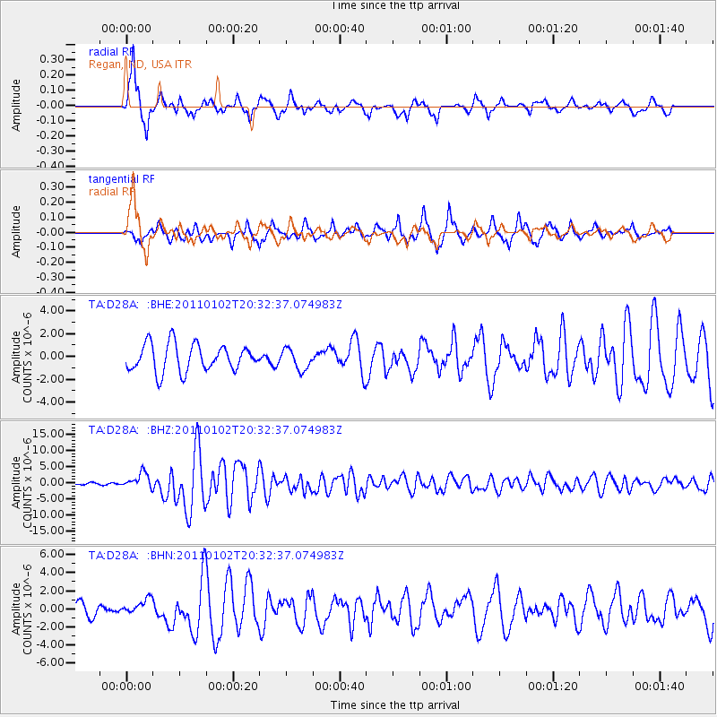
D28A Regan, ND, USA - Earthquake Result Viewer
*The percent match for this event was below the threshold and hence no stack was calculated.
| Earthquake location: |
Near Coast Of Central Chile |
| Earthquake latitude/longitude: |
-38.4/-73.3 |
| Earthquake time(UTC): |
2011/01/02 (002) 20:20:17 GMT |
| Earthquake Depth: |
24 km |
| Earthquake Magnitude: |
6.6 MB, 7.1 MS, 7.1 MW, 7.0 MW |
| Earthquake Catalog/Contributor: |
WHDF/NEIC |
|
| Network: |
TA USArray Transportable Network (new EarthScope stations) |
| Station: |
D28A Regan, ND, USA |
| Lat/Lon: |
47.19 N/100.57 W |
| Elevation: |
621 m |
|
| Distance: |
88.6 deg |
| Az: |
341.803 deg |
| Baz: |
158.899 deg |
| Ray Param: |
$rayparam |
*The percent match for this event was below the threshold and hence was not used in the summary stack. |
|
| Radial Match: |
83.67067 % |
| Radial Bump: |
394 |
| Transverse Match: |
76.915726 % |
| Transverse Bump: |
400 |
| SOD ConfigId: |
346946 |
| Insert Time: |
2011-07-04 09:35:46.752 +0000 |
| GWidth: |
2.5 |
| Max Bumps: |
400 |
| Tol: |
0.001 |
|
Signal To Noise
| Channel | StoN | STA | LTA |
| TA:D28A: :BHZ:20110102T20:32:37.074983Z | 9.404614 | 2.3762755E-6 | 2.5267124E-7 |
| TA:D28A: :BHN:20110102T20:32:37.074983Z | 0.7276362 | 7.7941314E-7 | 1.0711577E-6 |
| TA:D28A: :BHE:20110102T20:32:37.074983Z | 0.7591923 | 9.0705095E-7 | 1.1947579E-6 |
| Arrivals |
| Ps | |
| PpPs | |
| PsPs/PpSs | |


