You are here: Home > Network List > US - United States National Seismic Network Stations List
> Station DGMT Dagmar, Montana, USA > Earthquake Result Viewer
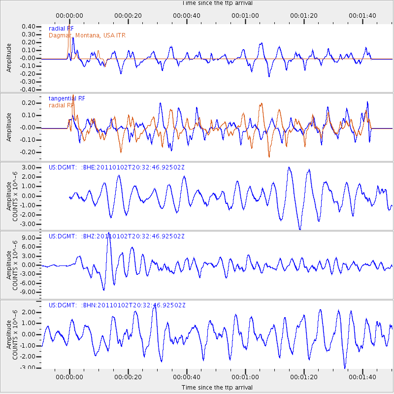
DGMT Dagmar, Montana, USA - Earthquake Result Viewer
*The percent match for this event was below the threshold and hence no stack was calculated.
| Earthquake location: |
Near Coast Of Central Chile |
| Earthquake latitude/longitude: |
-38.4/-73.3 |
| Earthquake time(UTC): |
2011/01/02 (002) 20:20:17 GMT |
| Earthquake Depth: |
24 km |
| Earthquake Magnitude: |
6.6 MB, 7.1 MS, 7.1 MW, 7.0 MW |
| Earthquake Catalog/Contributor: |
WHDF/NEIC |
|
| Network: |
US United States National Seismic Network |
| Station: |
DGMT Dagmar, Montana, USA |
| Lat/Lon: |
48.47 N/104.20 W |
| Elevation: |
0.0 m |
|
| Distance: |
90.7 deg |
| Az: |
340.033 deg |
| Baz: |
156.208 deg |
| Ray Param: |
$rayparam |
*The percent match for this event was below the threshold and hence was not used in the summary stack. |
|
| Radial Match: |
74.079865 % |
| Radial Bump: |
400 |
| Transverse Match: |
57.875103 % |
| Transverse Bump: |
400 |
| SOD ConfigId: |
346946 |
| Insert Time: |
2011-07-04 11:00:17.128 +0000 |
| GWidth: |
2.5 |
| Max Bumps: |
400 |
| Tol: |
0.001 |
|
Signal To Noise
| Channel | StoN | STA | LTA |
| US:DGMT: :BHZ:20110102T20:32:46.92502Z | 6.541411 | 1.6045377E-6 | 2.4528924E-7 |
| US:DGMT: :BHN:20110102T20:32:46.92502Z | 0.7401913 | 6.933609E-7 | 9.367321E-7 |
| US:DGMT: :BHE:20110102T20:32:46.92502Z | 0.9207792 | 8.858836E-7 | 9.621021E-7 |
| Arrivals |
| Ps | |
| PpPs | |
| PsPs/PpSs | |


