You are here: Home > Network List > UW - Pacific Northwest Regional Seismic Network Stations List
> Station MRBL Marblemount, WA, USA > Earthquake Result Viewer
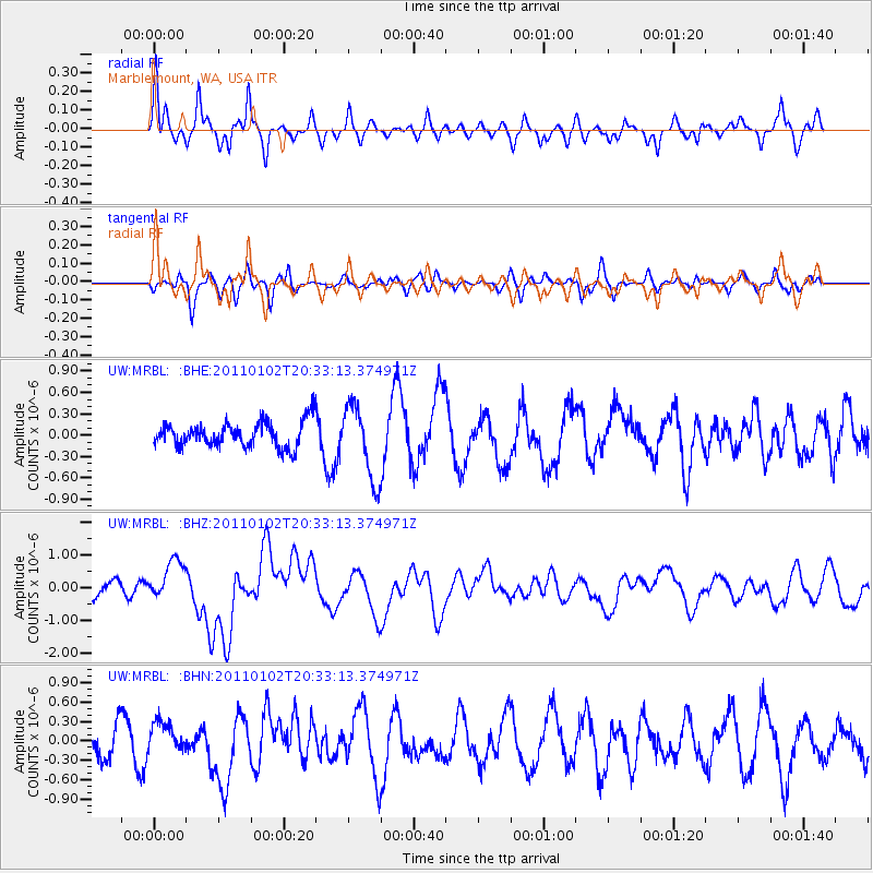
MRBL Marblemount, WA, USA - Earthquake Result Viewer
*The percent match for this event was below the threshold and hence no stack was calculated.
| Earthquake location: |
Near Coast Of Central Chile |
| Earthquake latitude/longitude: |
-38.4/-73.3 |
| Earthquake time(UTC): |
2011/01/02 (002) 20:20:17 GMT |
| Earthquake Depth: |
24 km |
| Earthquake Magnitude: |
6.6 MB, 7.1 MS, 7.1 MW, 7.0 MW |
| Earthquake Catalog/Contributor: |
WHDF/NEIC |
|
| Network: |
UW Pacific Northwest Regional Seismic Network |
| Station: |
MRBL Marblemount, WA, USA |
| Lat/Lon: |
48.52 N/121.48 W |
| Elevation: |
75 m |
|
| Distance: |
96.5 deg |
| Az: |
330.098 deg |
| Baz: |
143.88 deg |
| Ray Param: |
$rayparam |
*The percent match for this event was below the threshold and hence was not used in the summary stack. |
|
| Radial Match: |
72.5836 % |
| Radial Bump: |
328 |
| Transverse Match: |
30.886503 % |
| Transverse Bump: |
268 |
| SOD ConfigId: |
346946 |
| Insert Time: |
2011-07-04 11:10:32.991 +0000 |
| GWidth: |
2.5 |
| Max Bumps: |
400 |
| Tol: |
0.001 |
|
Signal To Noise
| Channel | StoN | STA | LTA |
| UW:MRBL: :BHZ:20110102T20:33:13.374971Z | 2.448748 | 6.0706674E-7 | 2.4790904E-7 |
| UW:MRBL: :BHN:20110102T20:33:13.374971Z | 1.0771432 | 2.29738E-7 | 2.1328457E-7 |
| UW:MRBL: :BHE:20110102T20:33:13.374971Z | 2.9520202 | 5.183048E-7 | 1.755763E-7 |
| Arrivals |
| Ps | |
| PpPs | |
| PsPs/PpSs | |


