You are here: Home > Network List > TA - USArray Transportable Network (new EarthScope stations) Stations List
> Station L44A Lake County Forest Preserve, Grayslake, IL, USA > Earthquake Result Viewer
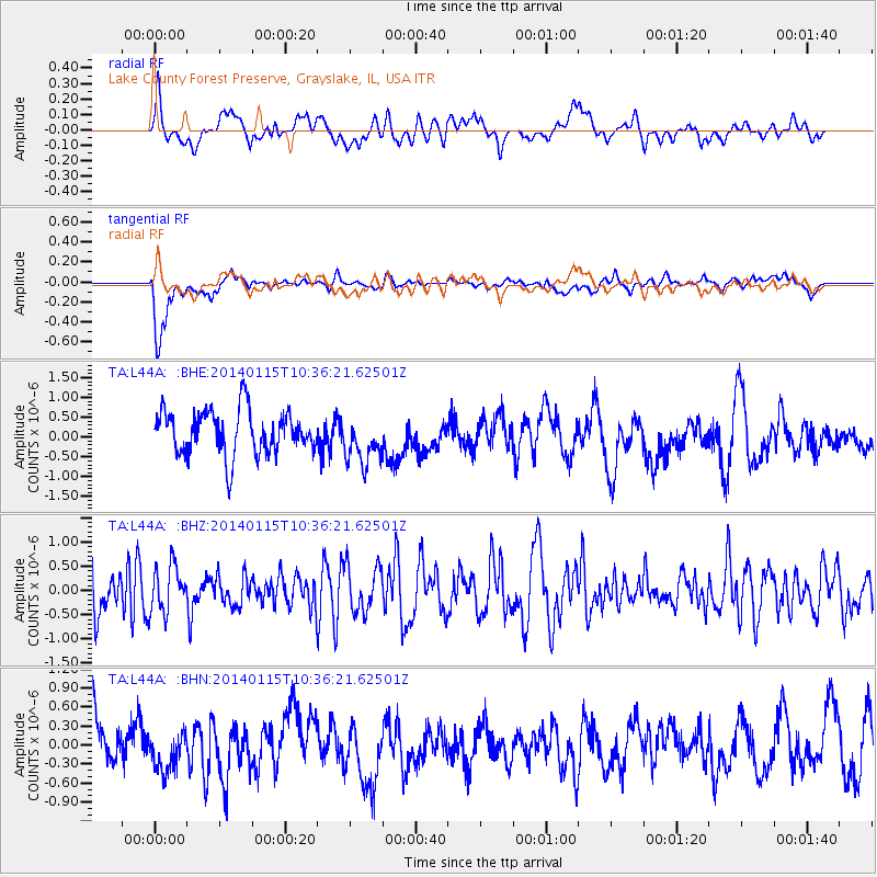
L44A Lake County Forest Preserve, Grayslake, IL, USA - Earthquake Result Viewer
*The percent match for this event was below the threshold and hence no stack was calculated.
| Earthquake location: |
Kuril Islands |
| Earthquake latitude/longitude: |
47.1/152.3 |
| Earthquake time(UTC): |
2014/01/15 (015) 10:25:14 GMT |
| Earthquake Depth: |
107 km |
| Earthquake Magnitude: |
4.5 mb |
| Earthquake Catalog/Contributor: |
ISC/ISC |
|
| Network: |
TA USArray Transportable Network (new EarthScope stations) |
| Station: |
L44A Lake County Forest Preserve, Grayslake, IL, USA |
| Lat/Lon: |
42.18 N/87.91 W |
| Elevation: |
202 m |
|
| Distance: |
76.4 deg |
| Az: |
41.563 deg |
| Baz: |
322.399 deg |
| Ray Param: |
$rayparam |
*The percent match for this event was below the threshold and hence was not used in the summary stack. |
|
| Radial Match: |
51.44566 % |
| Radial Bump: |
400 |
| Transverse Match: |
67.57104 % |
| Transverse Bump: |
400 |
| SOD ConfigId: |
3390531 |
| Insert Time: |
2019-04-10 00:24:49.702 +0000 |
| GWidth: |
2.5 |
| Max Bumps: |
400 |
| Tol: |
0.001 |
|
Signal To Noise
| Channel | StoN | STA | LTA |
| TA:L44A: :BHZ:20140115T10:36:21.62501Z | 0.7505672 | 4.7703804E-7 | 6.3557013E-7 |
| TA:L44A: :BHN:20140115T10:36:21.62501Z | 0.75936276 | 3.1577517E-7 | 4.1584232E-7 |
| TA:L44A: :BHE:20140115T10:36:21.62501Z | 1.0743964 | 5.945087E-7 | 5.5334215E-7 |
| Arrivals |
| Ps | |
| PpPs | |
| PsPs/PpSs | |


