You are here: Home > Network List > MN - MEDNET Project Stations List
> Station TIP Timpagrande, Italy > Earthquake Result Viewer
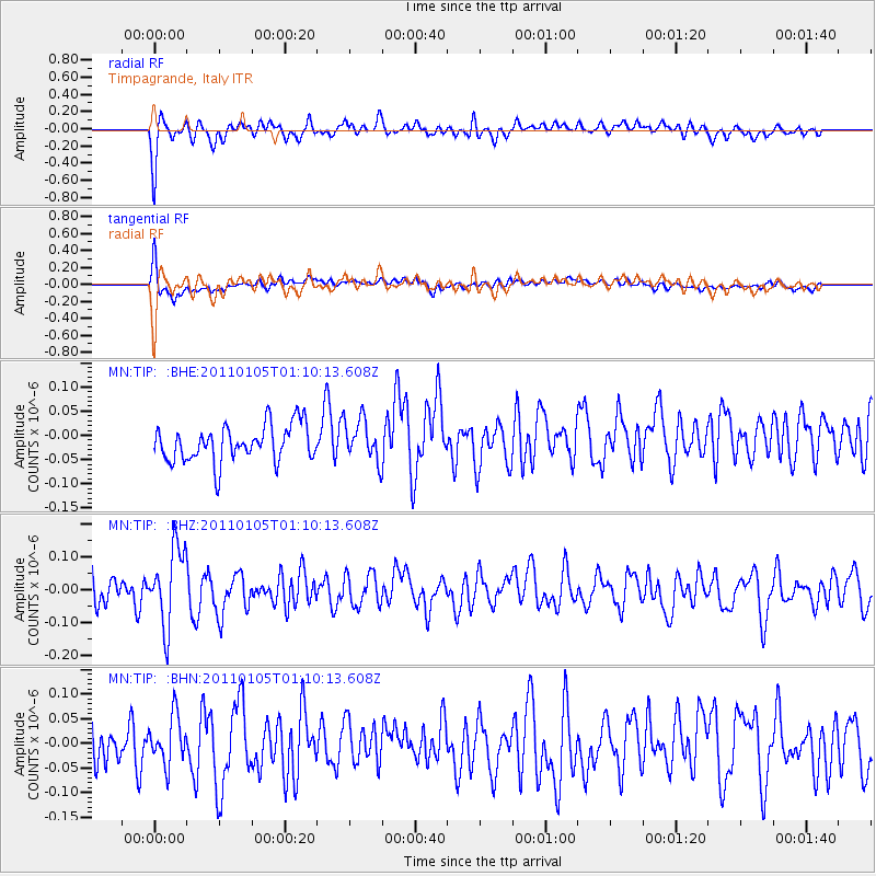
TIP Timpagrande, Italy - Earthquake Result Viewer
*The percent match for this event was below the threshold and hence no stack was calculated.
| Earthquake location: |
Southeast Of Honshu, Japan |
| Earthquake latitude/longitude: |
31.5/142.2 |
| Earthquake time(UTC): |
2011/01/05 (005) 00:57:32 GMT |
| Earthquake Depth: |
21 km |
| Earthquake Magnitude: |
6.0 MB, 5.4 MS, 5.6 MW |
| Earthquake Catalog/Contributor: |
WHDF/NEIC |
|
| Network: |
MN MEDNET Project |
| Station: |
TIP Timpagrande, Italy |
| Lat/Lon: |
39.18 N/16.76 E |
| Elevation: |
789 m |
|
| Distance: |
93.3 deg |
| Az: |
320.622 deg |
| Baz: |
44.18 deg |
| Ray Param: |
$rayparam |
*The percent match for this event was below the threshold and hence was not used in the summary stack. |
|
| Radial Match: |
56.93965 % |
| Radial Bump: |
327 |
| Transverse Match: |
71.651405 % |
| Transverse Bump: |
400 |
| SOD ConfigId: |
346946 |
| Insert Time: |
2011-07-04 12:12:59.299 +0000 |
| GWidth: |
2.5 |
| Max Bumps: |
400 |
| Tol: |
0.001 |
|
Signal To Noise
| Channel | StoN | STA | LTA |
| MN:TIP: :BHZ:20110105T01:10:13.608Z | 2.7344294 | 1.1804991E-7 | 4.317168E-8 |
| MN:TIP: :BHN:20110105T01:10:13.608Z | 1.1835221 | 4.8162452E-8 | 4.0694168E-8 |
| MN:TIP: :BHE:20110105T01:10:13.608Z | 1.13769 | 4.2682675E-8 | 3.7516966E-8 |
| Arrivals |
| Ps | |
| PpPs | |
| PsPs/PpSs | |


