You are here: Home > Network List > TA - USArray Transportable Network (new EarthScope stations) Stations List
> Station L29A Maesberg Ranch, Thedford, NE, USA > Earthquake Result Viewer
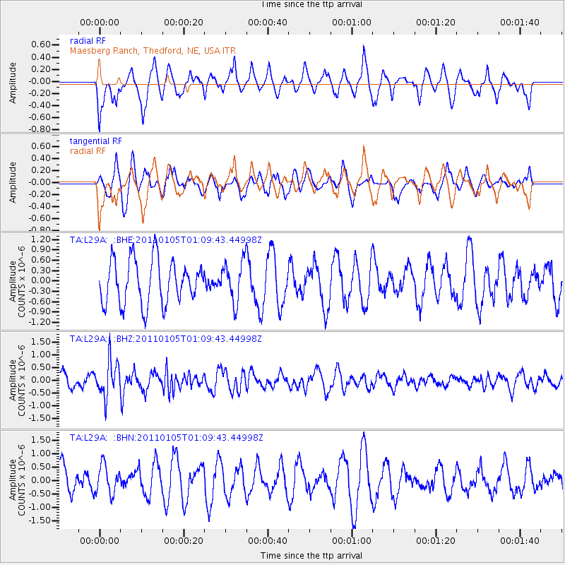
L29A Maesberg Ranch, Thedford, NE, USA - Earthquake Result Viewer
*The percent match for this event was below the threshold and hence no stack was calculated.
| Earthquake location: |
Southeast Of Honshu, Japan |
| Earthquake latitude/longitude: |
31.5/142.2 |
| Earthquake time(UTC): |
2011/01/05 (005) 00:57:32 GMT |
| Earthquake Depth: |
21 km |
| Earthquake Magnitude: |
6.0 MB, 5.4 MS, 5.6 MW |
| Earthquake Catalog/Contributor: |
WHDF/NEIC |
|
| Network: |
TA USArray Transportable Network (new EarthScope stations) |
| Station: |
L29A Maesberg Ranch, Thedford, NE, USA |
| Lat/Lon: |
42.06 N/100.48 W |
| Elevation: |
901 m |
|
| Distance: |
86.8 deg |
| Az: |
41.486 deg |
| Baz: |
310.575 deg |
| Ray Param: |
$rayparam |
*The percent match for this event was below the threshold and hence was not used in the summary stack. |
|
| Radial Match: |
56.904037 % |
| Radial Bump: |
357 |
| Transverse Match: |
61.35683 % |
| Transverse Bump: |
369 |
| SOD ConfigId: |
346946 |
| Insert Time: |
2011-07-04 12:32:42.006 +0000 |
| GWidth: |
2.5 |
| Max Bumps: |
400 |
| Tol: |
0.001 |
|
Signal To Noise
| Channel | StoN | STA | LTA |
| TA:L29A: :BHZ:20110105T01:09:43.44998Z | 3.6124175 | 7.170316E-7 | 1.984908E-7 |
| TA:L29A: :BHN:20110105T01:09:43.44998Z | 0.82666814 | 5.318241E-7 | 6.433345E-7 |
| TA:L29A: :BHE:20110105T01:09:43.44998Z | 0.9543381 | 6.1409344E-7 | 6.4347574E-7 |
| Arrivals |
| Ps | |
| PpPs | |
| PsPs/PpSs | |


